Waterfront Land with Private
123 Waterview Road Lancaster, VA 22503
For Sale
Contact for pricing
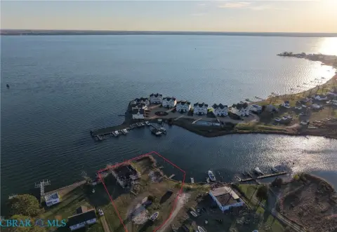
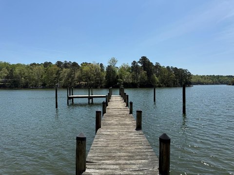
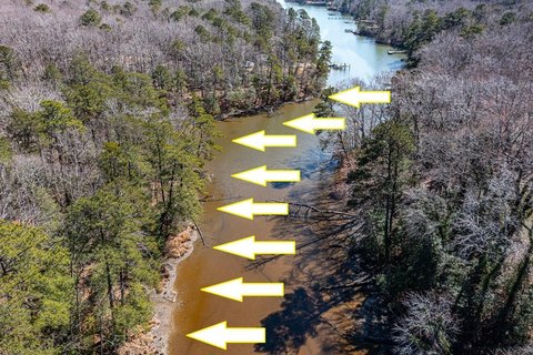
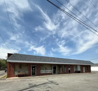
Protected harbor parcel with dock, bulkhead, and substantial shoreline for water-dependent or recreational opportunities.
Property Size3,412 SF
Price / SF$84.99
Days on Market93
Property Features for 123 Waterview Road
General Information
- Standard status
- Active
- Size
- 3,412 SF
- Property subtype
- Land, Special Purpose
Listing Agency:
Garrett Realty Partners
Listed By:
Adam Garrett · License #0225216530
Source:
Crexi
Added: Apr 22
Changed: Jul 10
Last Checked: Jul 23 at 6:52AM
Displayed information is deemed reliable but is not guaranteed and should be independently verified. All listing content including descriptions, pricing, images are the copyrighted material of Garrett Realty Partners
Investment Insights
Based on property information with market context.
This waterfront land offering includes an existing dock and bulkhead, along with approximately 300 feet of shoreline in a protected harbor setting. A building footprint of approximately 3,412 square feet is positioned near the water, and the property is being sold as-is. The former oyster house presents a water-oriented foundation for a future concept, subject to required county approvals.
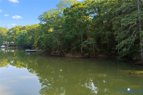
The parcel’s setting is described as navigable water with brackish conditions, which may support a mix of saltwater and freshwater fishing. Compared with more open bay exposure, the protected harbor conditions are intended to be calmer for vessels and docking. The buyer should verify all regulatory and environmental details; National Wetlands Inventory mapping indicates no significant wetlands on the parcel (buyer to verify), and waterfront overlay regulations are noted as an item for buyer confirmation.
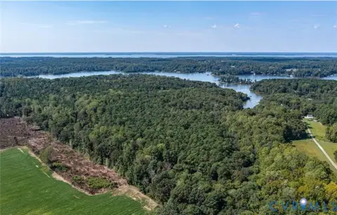
For operators, buyers, or tenants looking for water-access functionality, this property’s dock, shoreline, and navigable location provide a practical platform for water-dependent use, pending approval. The navigable connection to the Chesapeake Bay is described as approximately 25 miles by boat. A 3D tour is available, and prospective buyers should review the existing improvements and conditions onsite.
The parcel’s setting is described as navigable water with brackish conditions, which may support a mix of saltwater and freshwater fishing. Compared with more open bay exposure, the protected harbor conditions are intended to be calmer for vessels and docking. The buyer should verify all regulatory and environmental details; National Wetlands Inventory mapping indicates no significant wetlands on the parcel (buyer to verify), and waterfront overlay regulations are noted as an item for buyer confirmation.
For operators, buyers, or tenants looking for water-access functionality, this property’s dock, shoreline, and navigable location provide a practical platform for water-dependent use, pending approval. The navigable connection to the Chesapeake Bay is described as approximately 25 miles by boat. A 3D tour is available, and prospective buyers should review the existing improvements and conditions onsite.
Key Highlights
- Protected harbor parcel with dock, bulkhead, and approx. 300' of shoreline (buyer to verify).
- Includes an approx. 3,412 sq ft building footprint positioned near the water.
- Former oyster house with potential for water‑dependent use, subject to county approval.
Property Analytics
Property Profile
Location Intelligence
Current Use by Public Records
Waterfront Land


FAQs
What type of property is this?
Waterfront Land - Protected harbor parcel with dock, bulkhead, and substantial shoreline for water-dependent or recreational opportunities.
Where is this waterfront land located?
The property is located at 123 Waterview Road Lancaster, VA.
What is the asking price?
The asking price for this property is $290,000.
What are key features of this property?
This property features: Protected harbor parcel with dock, bulkhead, and approx. 300' of shoreline (buyer to verify).; Includes an approx. 3,412 sq ft building footprint positioned near the water.; Former oyster house with potential for water‑dependent use, subject to county approval.


