Residential View Lot in


For Sale
$249,900
Telegraph Dr, Coos Bay, OR 97420
LAND - CoosBay, OR
Lot Size0.20 Acres
Days on Market56
Property Features for Telegraph Dr
General Information
Property type
Land
Property subtype
Single Family Residence
Zoning
R-1
View
City, Valley
Elementary school
Coos Bay
Middle school
Coos Bay
High school
Marshfield
Directions
Park Ave. to Telegraph Dr.
Subdivision
_260
Standard status
Active
APN
99921489
Lot size
0.20 Acres
Taxes and HOA fees
Tax Description
25S-13W-26CB TL 1101
Tax Annual Amount
845
Legal Description
25S-13W-26CB TL 1101
Listing Agency:
Pacific Coast Real Estate & Development, LLC
(541) 808-3297
Listed By:
Dylan Fox · License #201230584
(541) 297-8894
Added: Jun 5
Changed: Jul 30
Last Checked: Jul 30 at 4:06PM
MLS# 646053820
Copyright © 2026 Regional Multiple Listing Services. All rights reserved. All information provided by the listing agent/broker is deemed reliable but is not guaranteed and should be independently verified.
Investment Insights
Based on property information with market context.
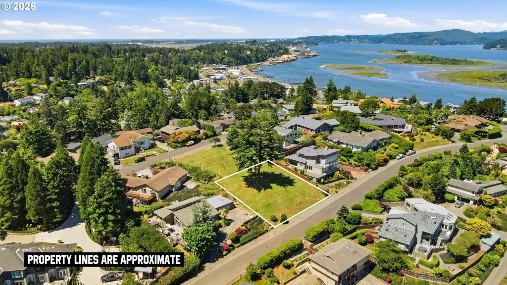
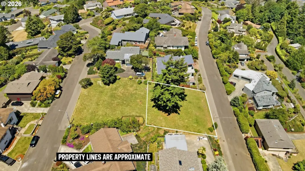
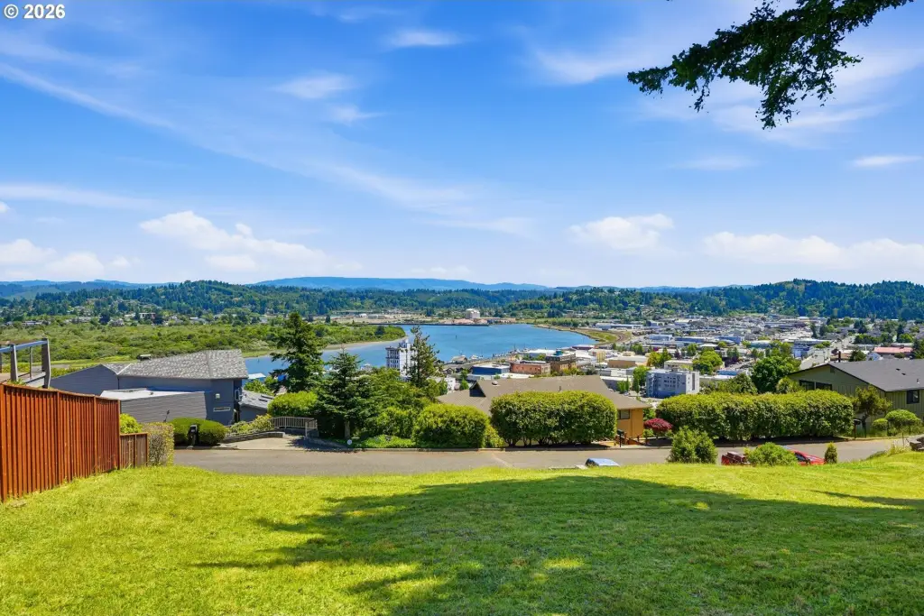
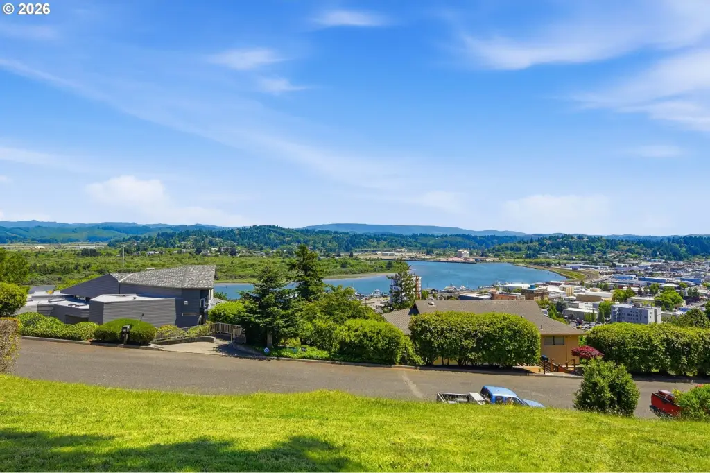
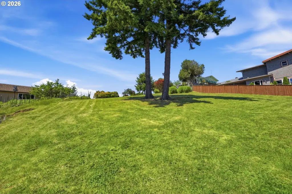
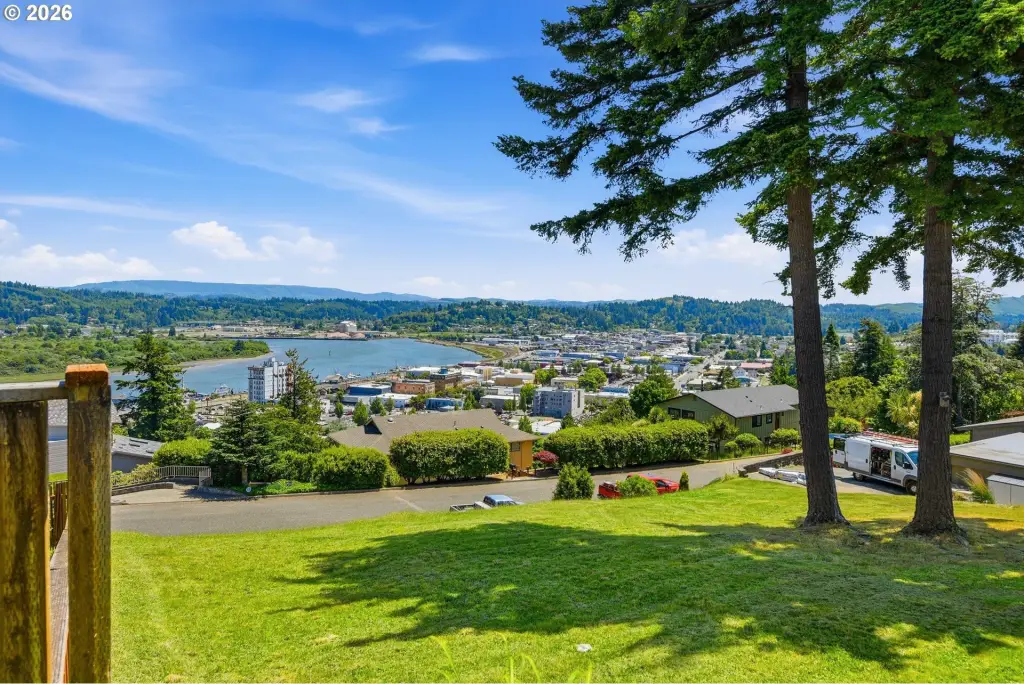
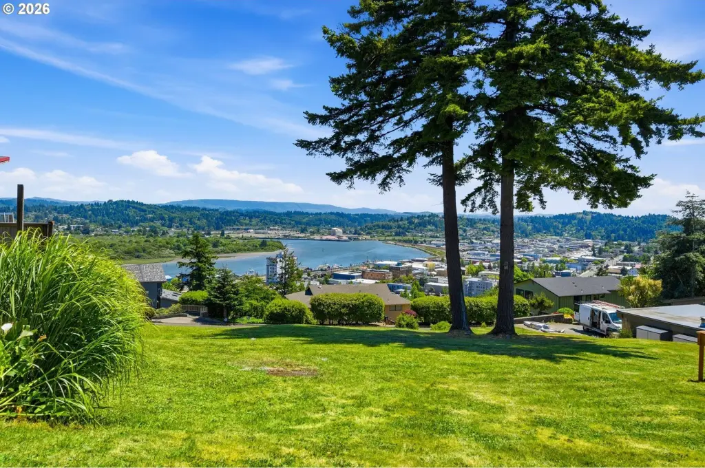
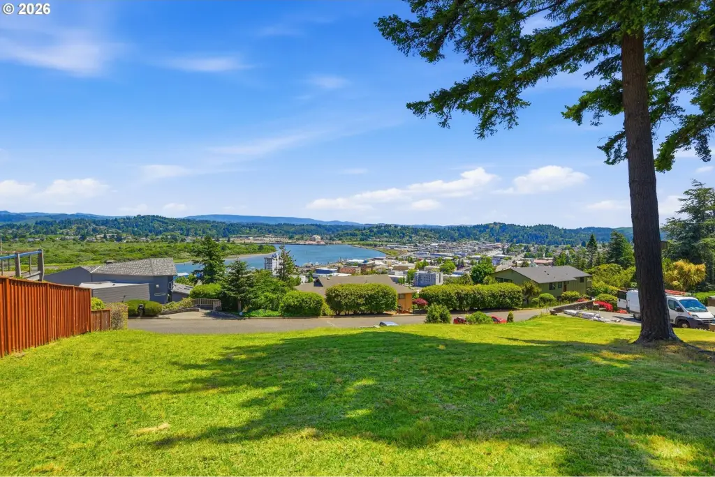
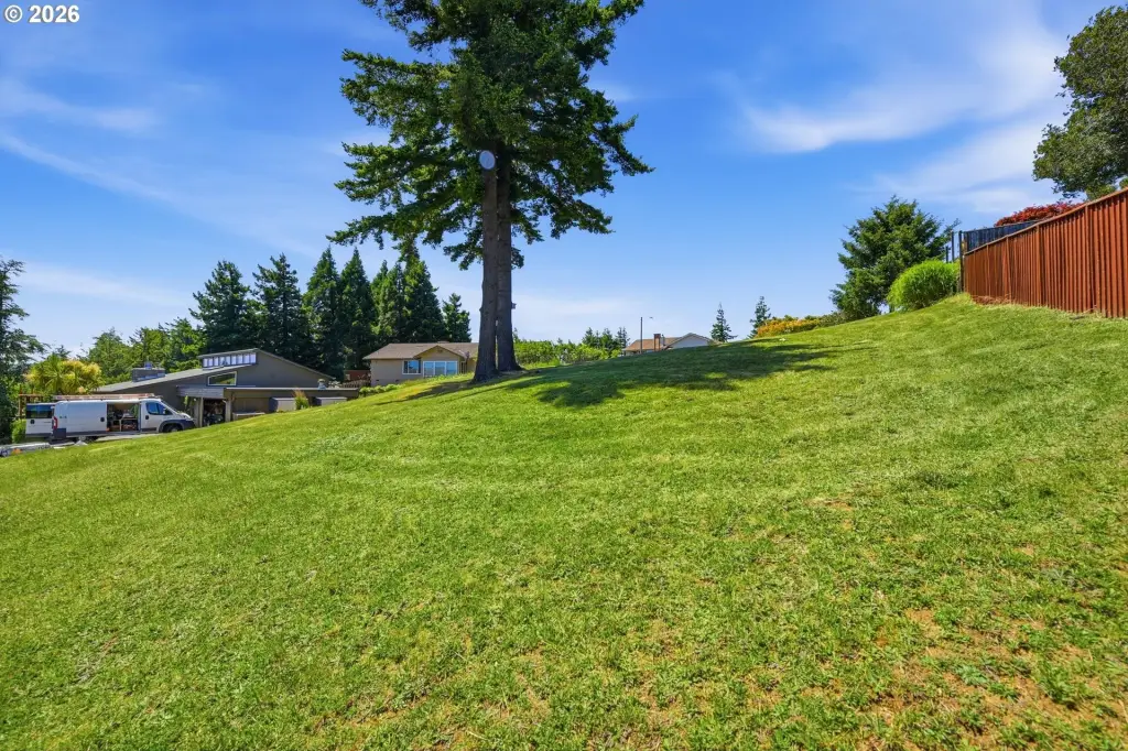
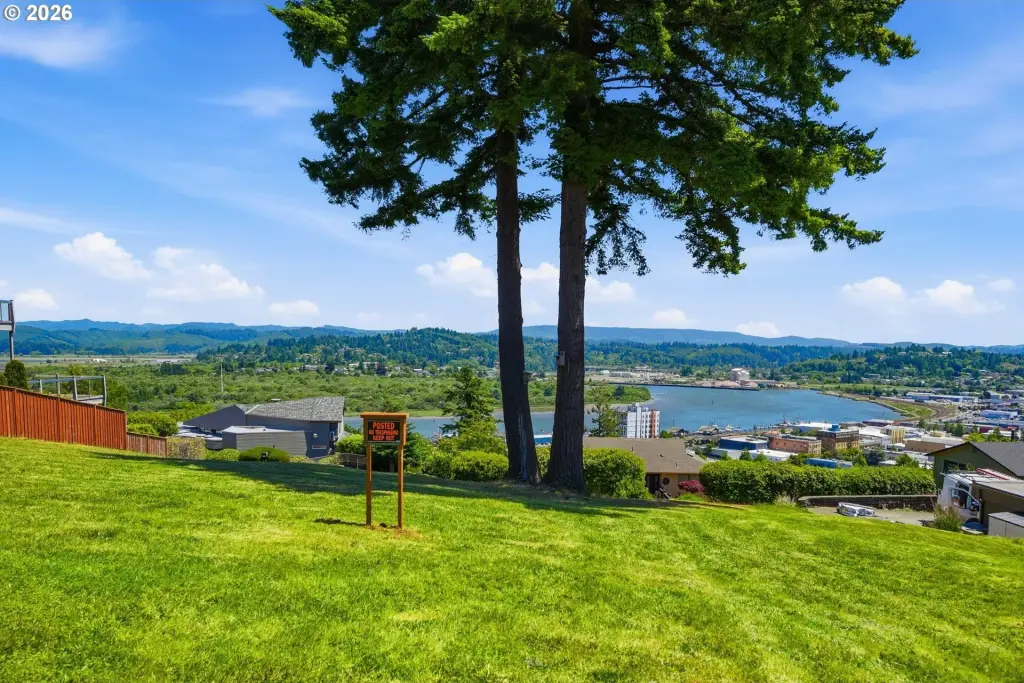
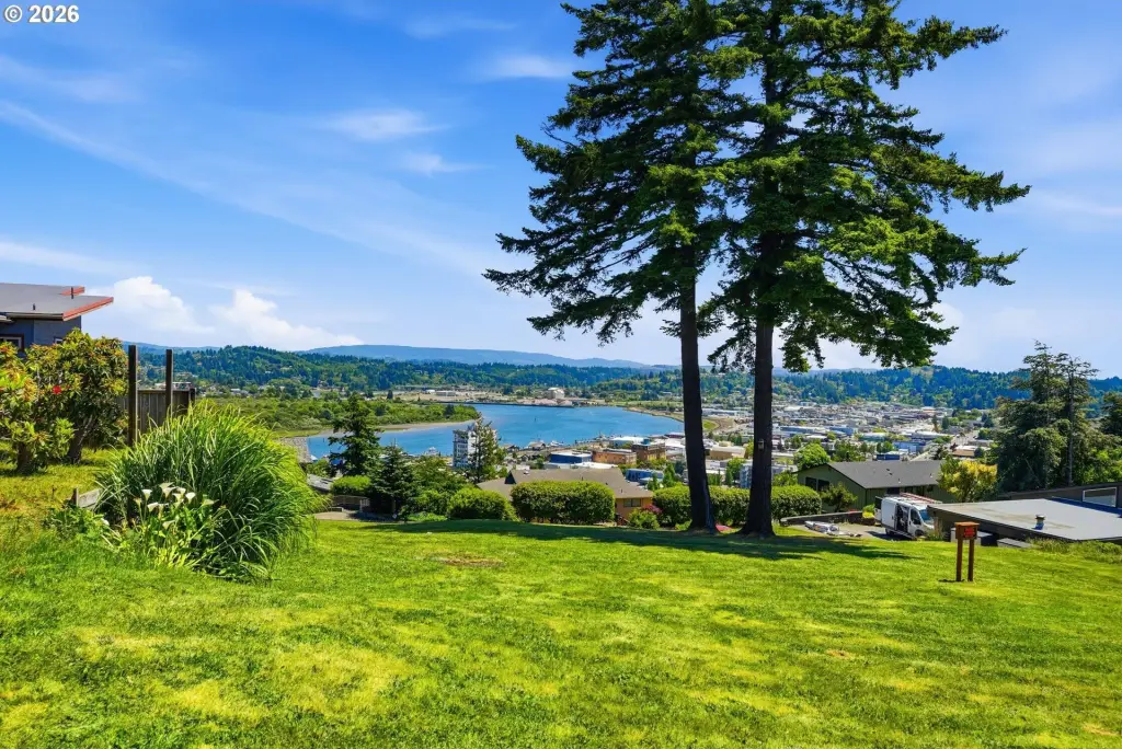
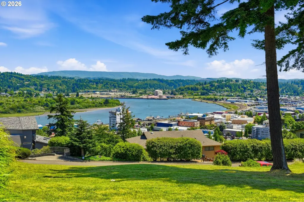
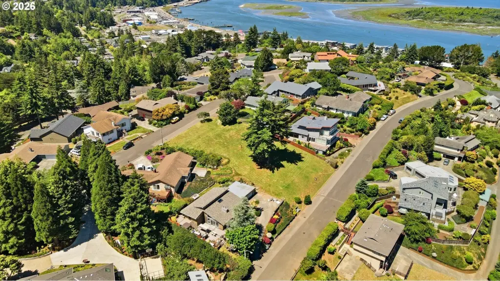
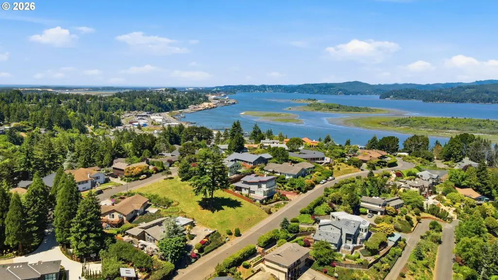
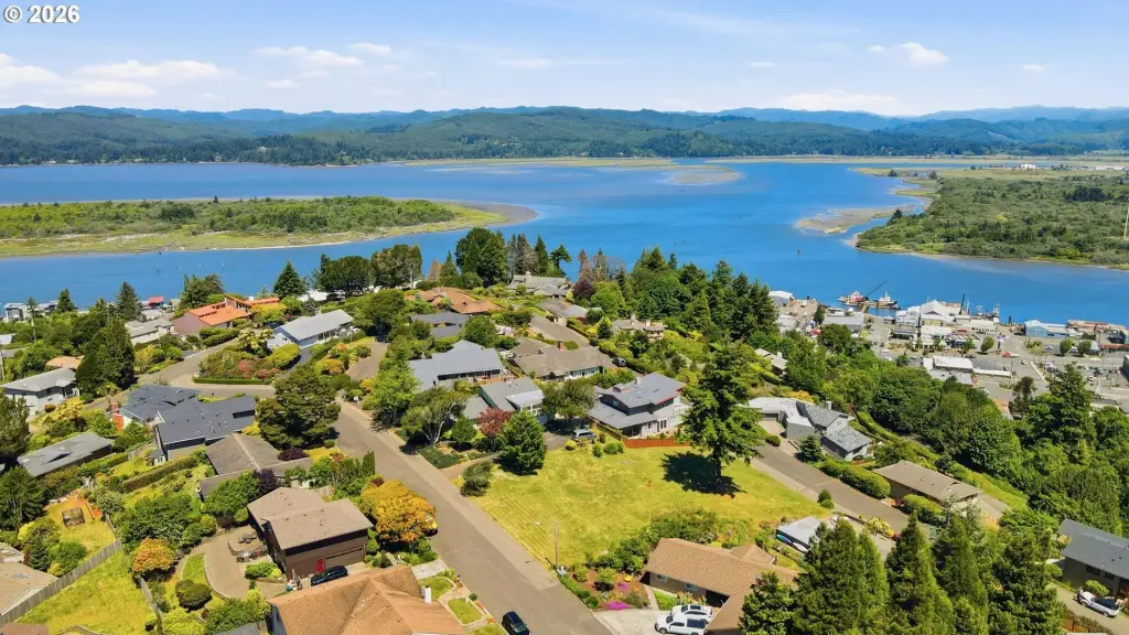
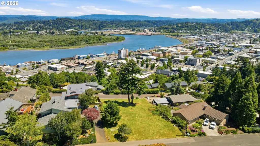
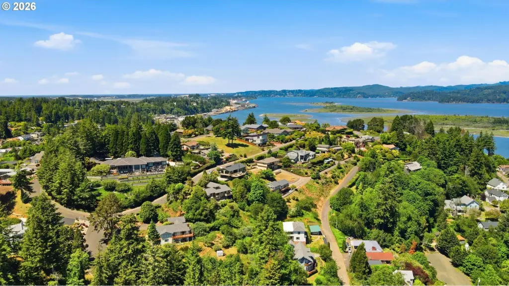
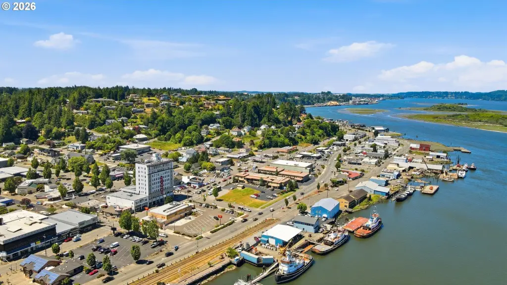
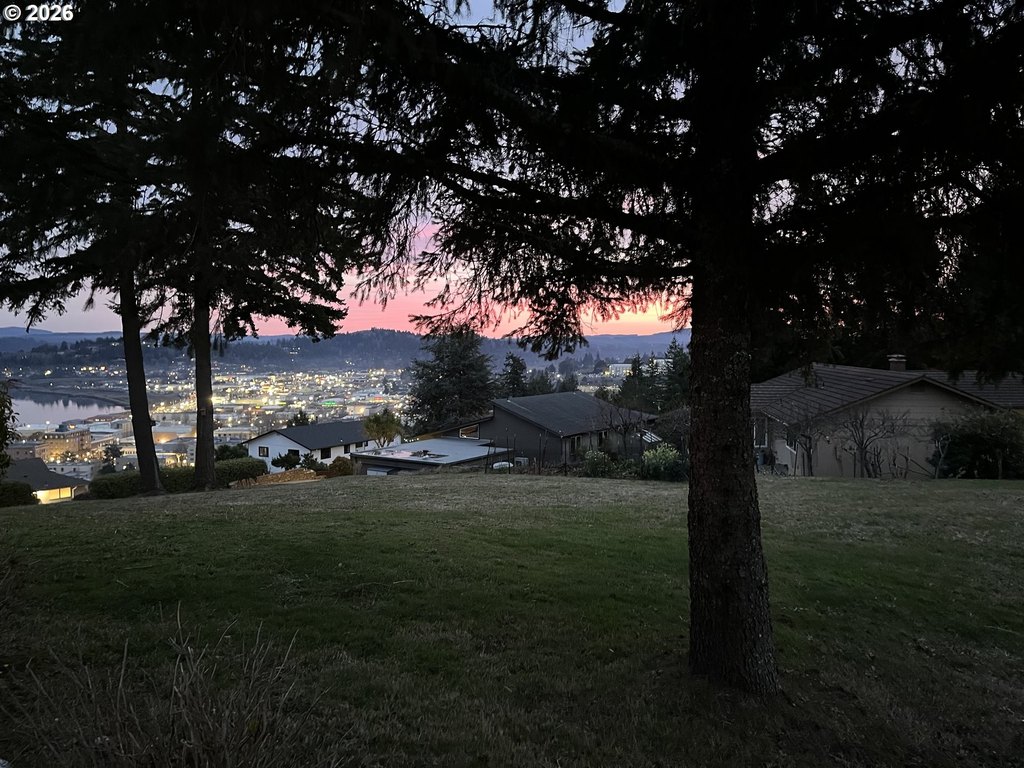
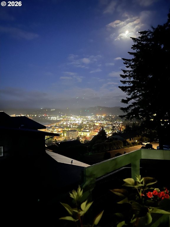
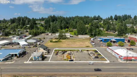
This residential lot in an R-1 zoning district is perched atop Telegraph Hill, offering elevated, panoramic views of the bay, downtown Coos Bay, and the surrounding coastal landscape. The property size is approximately 87 ft x 100 ft, with room to plan a custom home that takes advantage of the setting. City sewer, water, power, and cable are available, supporting a straightforward buildout for a future residence.
The lot is located in Coos Bay, with shopping, dining, and medical services described as being just minutes away, and a short drive to the hospital. Outdoor destinations in the area include Oregon Dunes National Recreation Area, Shore Acres State Park, and Cape Arago State Park. The listing also notes this is one of only two lots available on Telegraph Hill.
For homebuilders or buyers seeking a custom homesite with views, this parcel provides a defined residential footprint with utility availability in place. The property may also be purchased individually or combined with the adjacent lot for additional build flexibility. Whether you plan a standalone home or expand the footprint by pairing parcels, the lot’s elevated positioning and existing services are key practical considerations for the next stage of planning.
Key Highlights
- Buildable lot on Telegraph Hill in Coos Bay with panoramic views of the bay, downtown, and surrounding coastal landscape.
- One of only two lots available on Telegraph Hill, with an approximately 87 ft x 100 ft lot size.
- City sewer, water, power, and cable are available for the future custom build.
Property Analytics
Property Profile
Current Use
Lease Details
Yes
Utilities to site
Location Intelligence
Trade Area within ½ mile
865
Businesses Nearby
Explore this area
Business Placement
Demographics for 97420, OR
27,454
Population
12,967
Households
2.1
Avg Household Size
46
Median Age
19%
College-Educated
89%
High-School Grad
273.9 sq mi
ZIP Area
100
Density / Sq Mi
$61,624
Median Household Income
$35,536
Median Earnings
$982
Median Rent
$282,300
Median Home Value

Questions? Ask Rey
Realmo’s AI knows this listing — price, zoning, demand, history. Ask anything.


Frequently Asked Questions
What type of property is this?
Residential land & home lot - R-1 homesite with panoramic bay and city views, plus city sewer, water, power, and cable available for buildout.
Where is this residential land & home lot located?
The property is located at Telegraph Dr Coos Bay, OR.
What is the asking price?
The asking price for this property is $249,900.
What are key features of this property?
This property features: Buildable lot on Telegraph Hill in Coos Bay with panoramic views of the bay, downtown, and surrounding coastal landscape.; One of only two lots available on Telegraph Hill, with an approximately 87 ft x 100 ft lot size.; City sewer, water, power, and cable are available for the future custom build.


