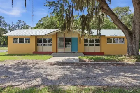
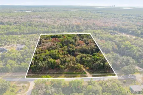
Multi-Zoned Development Land
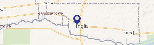
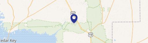
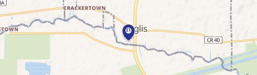
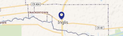
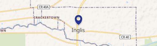
S Suncoast Boulevard Inglis, FL 34449

S Suncoast Boulevard, Inglis, FL, 34449
$1,250,000
For Sale
$1,250,000
LAND - Inglis, FL
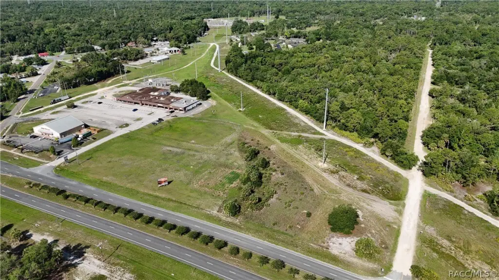
Lot Size36.20 Acres
Days on Market49
Property Features for S Suncoast Boulevard
General Information
- Property type
- Land
- Property subtype
- Other
- Zoning
- C1,R2,ULD
- Standard status
- Active
- APN
- 0305900000
- Lot size
- 36.20 Acres
Taxes and HOA fees
- Tax Year
- 2025
- Tax Description
- 03-17-16 0036.20 ACRES FRAC NW1/4 OF NE1/4 & FRAC NE1/4 OF NW1/4 & NW1/4 OF NW1/4 NORTH OF ROAD 40 & NE1/4 OF NE1/4 OR BOOK 629 PAGE 398 -LESS DB 81 PAGE 152 & DB 68 PAGE 89 & OR BOOK 73 PAGE 139 & LESS PART OF CASONS INGLIS ACRES UNIT 1 -LESS TRACTS SOLD-
- Tax Annual Amount
- 7049
Utilities
- Water source
- Public
Listing agency
Active Agent Realty LLC
(352) 228-8910
Listed by
David Bramblett · License #3026035
(352) 302-0448
Added: Jun 4 Updated: Jun 9 at 9:14AM Checked: Jul 22 at 6:06AM
MLS# 855282
Copyright © 2026 REALTORS Association of Citrus County, Inc. All rights reserved. All information provided by the listing agent/broker is deemed reliable but is not guaranteed and should be independently verified.
Investment Insights
Based on property information with market context.
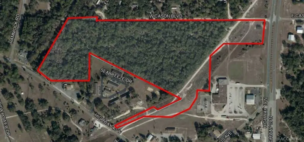
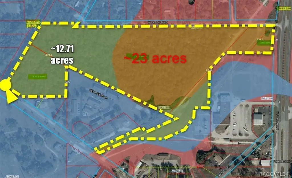
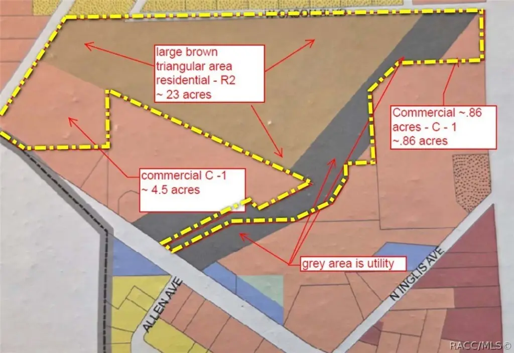
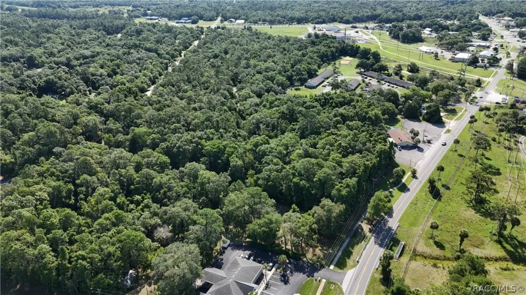
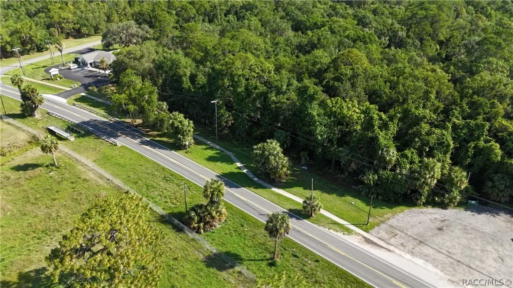
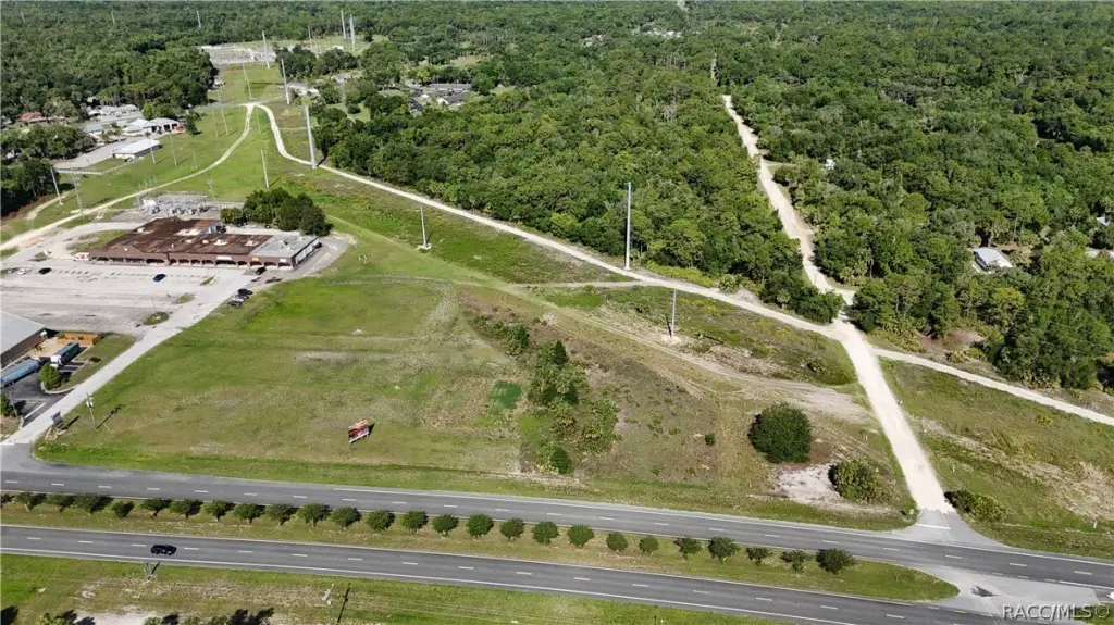
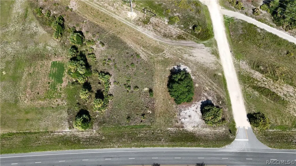
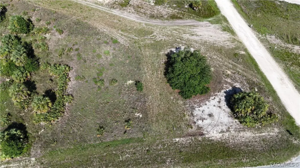
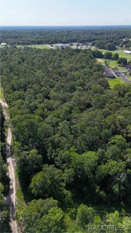
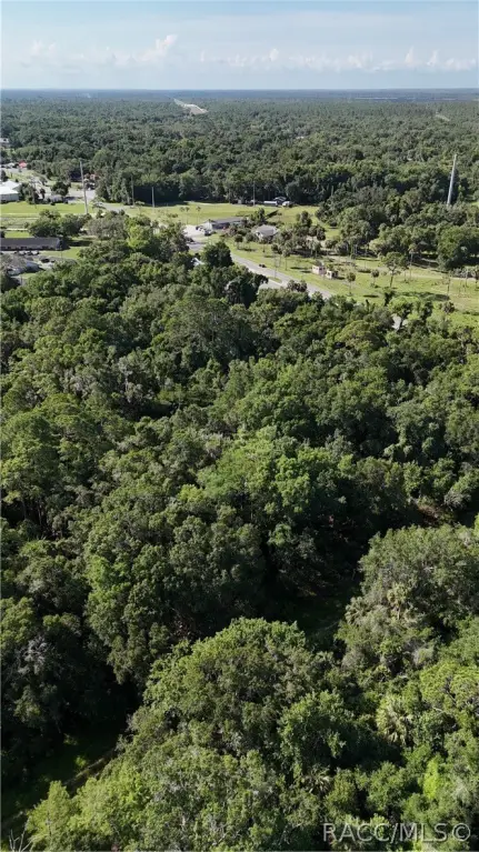
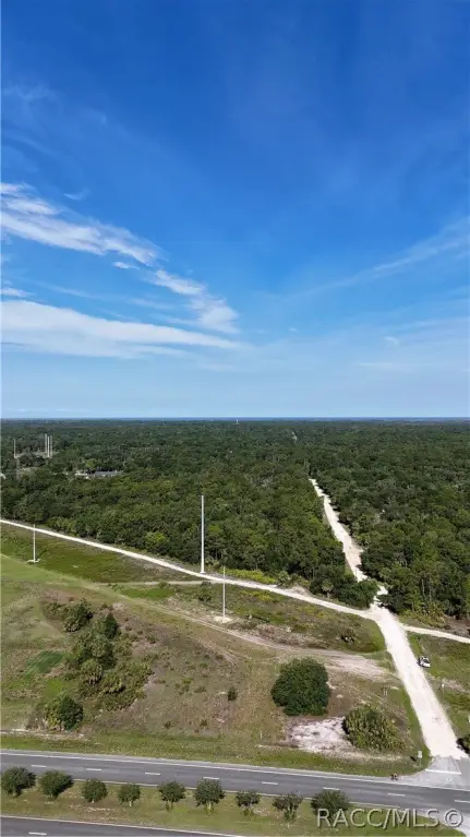
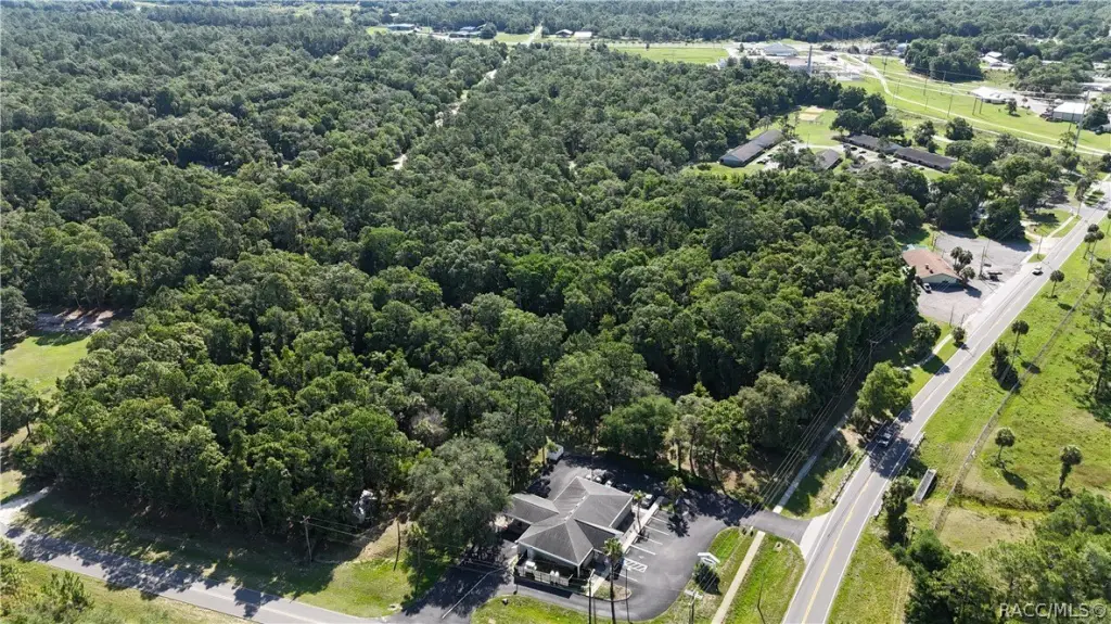
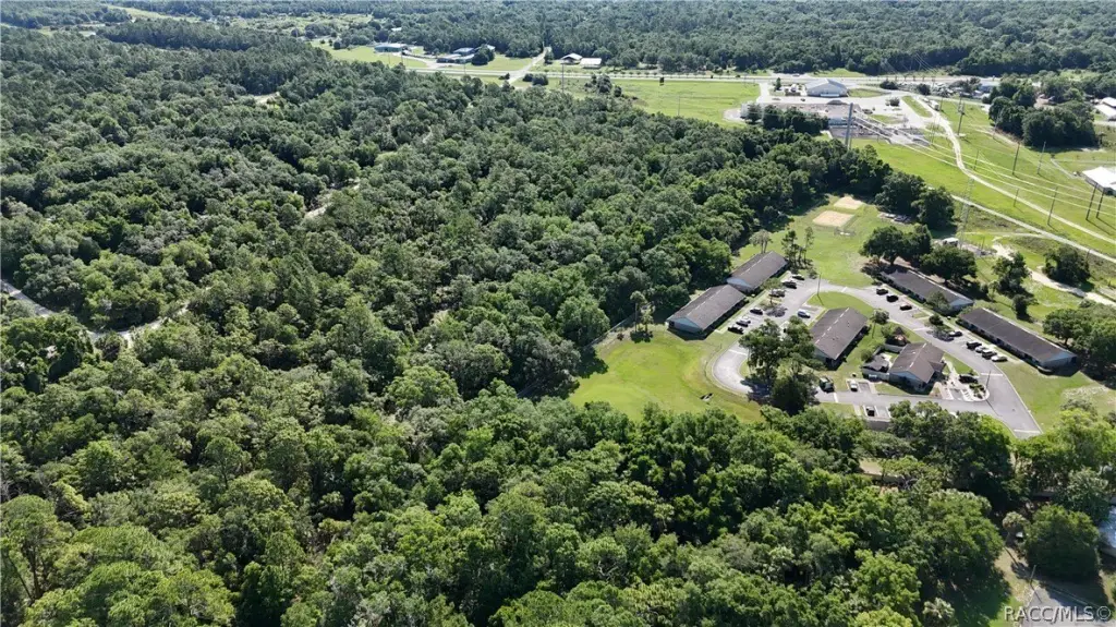
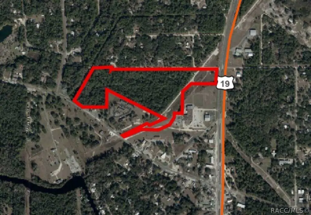
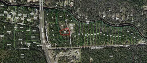
This offering is a 36.2-acre development parcel in the Town of Inglis with multiple zoning designations, including R-2 residential and C-1 neighborhood commercial. Approximately 23 acres are zoned R-2, supporting up to a maximum density of 5 units per acre, and can accommodate a mix of single-family, two-family, and multi-family residences. A portion of the residential acreage is located in Flood Zone X, which is described as not requiring additional building or elevation restrictions. Two commercially zoned areas are also included. Commercial area 1 is approximately 0.85 acres and is zoned C-1, with frontage along Highway 19/98 on the easternmost portion of the site and along Cason Blvd to the north; it is located in Flood Zone X. Commercial area 2 is approximately 4.75 acres (about 196,000 square feet) and is zoned C-1 along Follow That Dream Parkway, but is located in Flood Zone A, where improvements would be subject to building and elevation restrictions. A utility-zoned strip bisects the property and is described as roughly 5–6 acres where no vertical improvements may be placed.
Access and frontage vary by zone, with commercial area 1 presented as fronting Highway 19/98 and Cason Blvd, and commercial area 2 along Follow That Dream Parkway. Measurements in the description are approximate and not a survey. The listing notes city water availability and that town policy mandates connection to these systems.
For developers and land buyers, the value of the site centers on how it can be planned across residential and neighborhood commercial uses, while accounting for flood-zone boundaries and the utility-zoned area that limits vertical development. The property description also notes that a package sewer plant would be needed to support higher densities, consistent with the planning considerations described for this parcel. All zoning, flood-zone impacts, and development requirements should be confirmed with the Town of Inglis Zoning and Permitting Department.
Key Highlights
- 36.2 multi‑zoned acres in the Town of Inglis, including ~23 acres zoned R‑2 for up to 5 units per acre (~115 residential units).
- Roughly 15 acres of the R‑2 area are in Flood Zone X, which doesn’t require additional building or elevation restrictions.
- Two C‑1 (Neighborhood Commercial) areas: ~0.85 acres fronting Hwy 19/98 and Cason Blvd with ~270' frontage, plus ~4.75 acres along Follow That Dream Parkway.
Property Analytics
Property Profile
Location Intelligence
Current Use by Public Records
Residential land & home ...
Similar For Sale Nearby
FAQs
What type of property is this?
Residential land & home lot - Large multi-zoned acreage in Inglis with both residential and neighborhood commercial options for flexible site planning.
Where is this residential land & home lot located?
The property is located at S Suncoast Boulevard Inglis, FL.
What is the asking price?
The asking price for this property is $1,250,000.
What are key features of this property?
This property features: 36.2 multi‑zoned acres in the Town of Inglis, including ~23 acres zoned R‑2 for up to 5 units per acre (~115 residential units).; Roughly 15 acres of the R‑2 area are in Flood Zone X, which doesn’t require additional building or elevation restrictions.; Two C‑1 (Neighborhood Commercial) areas: ~0.85 acres fronting Hwy 19/98 and Cason Blvd with ~270' frontage, plus ~4.75 acres along Follow That Dream Parkway.


