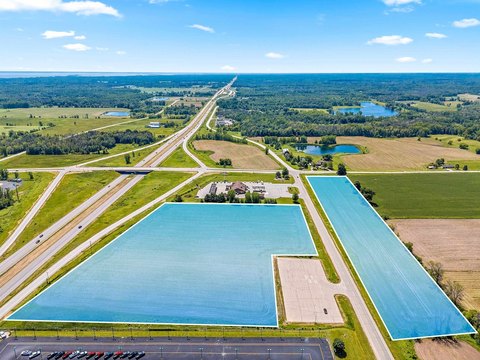
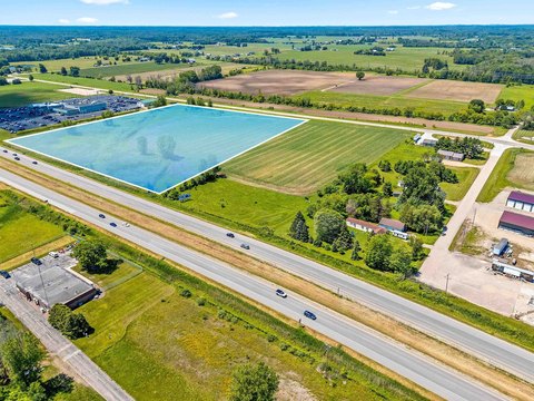
Agricultural Land
For Sale
$639,900
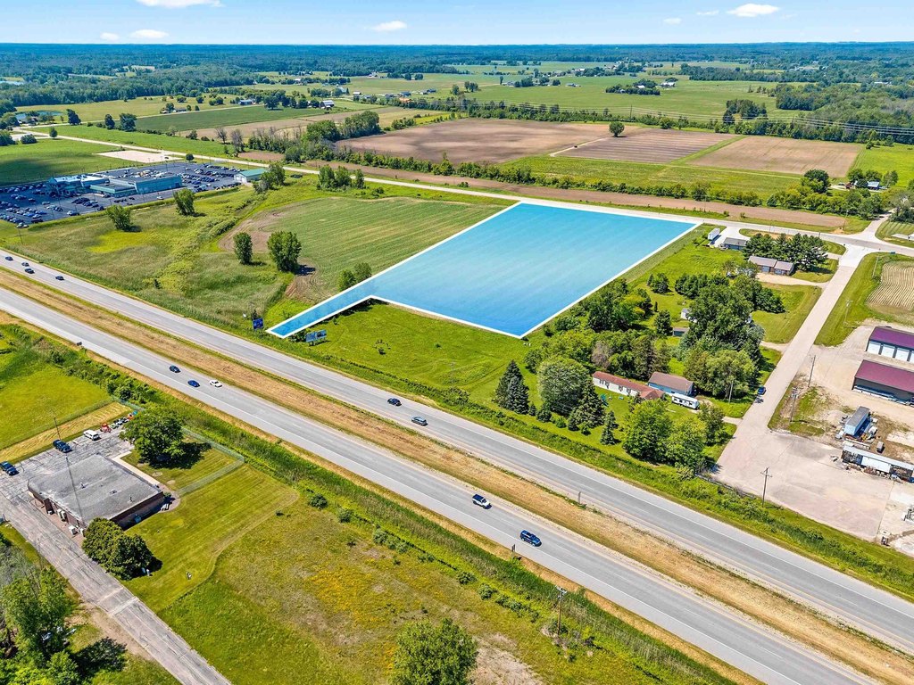
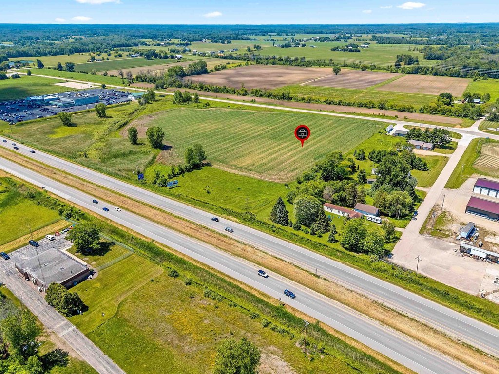
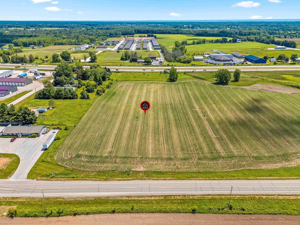
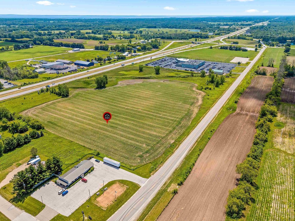
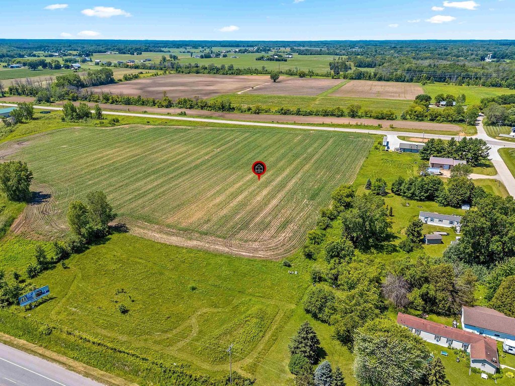
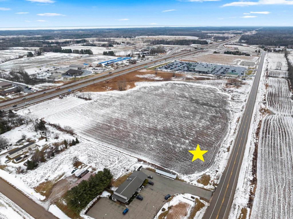
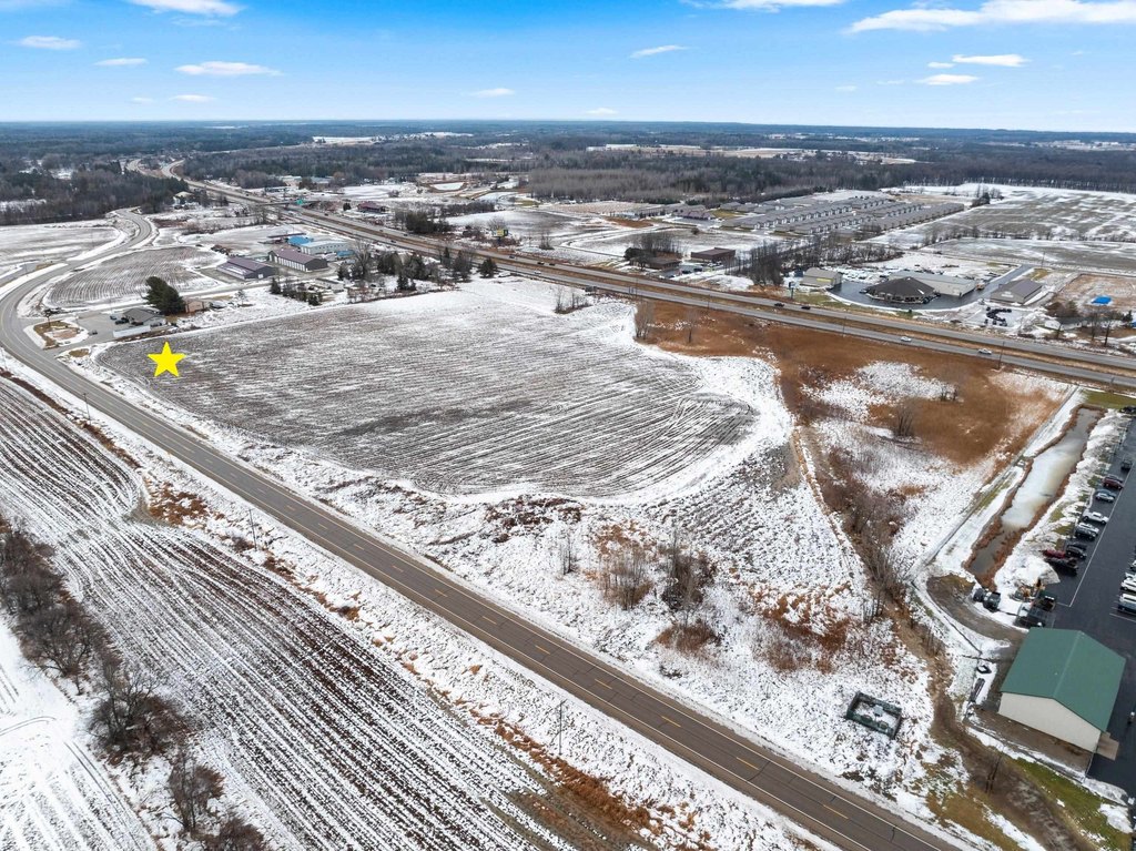
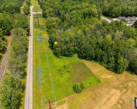
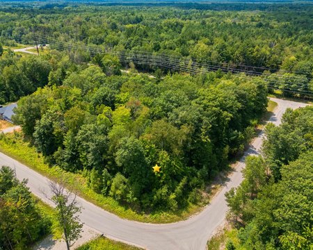
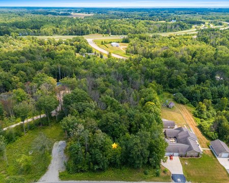
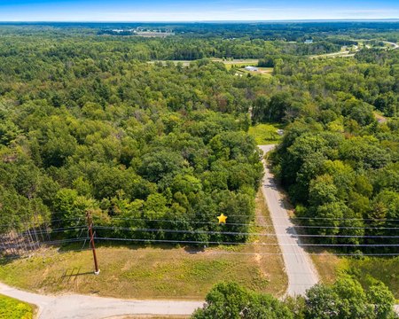
COUNTY ROAD EE, Abrams, WI 54101
LAND - ABRAMS, WI
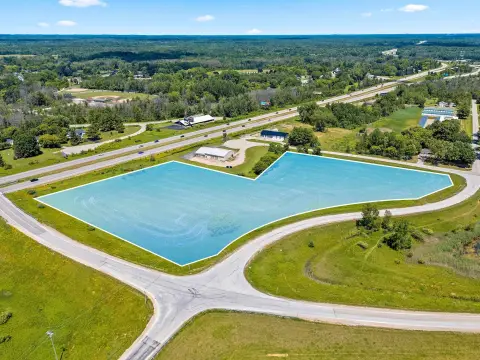
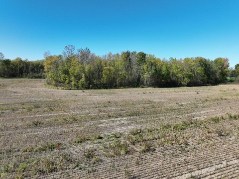
Lot Size6.42 Acres
Days on Market195
Property Features for COUNTY ROAD EE
General Information
Property type
Land
Property subtype
Other
Zoning
Agricultural
Lot features
Level, Rectangular Lot, Rural - Not Subdivision
Elementary school district
Oconto Falls
Middle school district
Oconto Falls
High school district
Oconto Falls
Directions
From Hwy 41, west on Sampson Rd, north on County EE to property on the right.
Standard status
Active
APN
002403401114B
Lot size
6.42 Acres
Taxes and HOA fees
Tax Year
2025
Tax Description
S1/2 OF SENE EXC V352-P354.AS IN V347-P111.EXC V553-P37,792.8,789-966, 815-889. N/K/A LOT 1 CSM V21-P1 891-188 513510
Tax Annual Amount
20
Legal Description
S1/2 OF SENE EXC V352-P354.AS IN V347-P111.EXC V553-P37,792.8,789-966, 815-889. N/K/A LOT 1 CSM V21-P1 891-188 513510
Utilities
Utilities
Phone Available
Sewer type
Public Sewer
Listing Agency:
Keller Williams Green Bay · Keller Williams Realty
(920) 632-7702
Listed By:
Cole R. Nuthals
(920) 655-2718
Added: Jan 16
Changed: Jul 30
Last Checked: Jul 30 at 5:06PM
MLS# 50320071
Copyright © 2026 Realtor Association of Northeast Wisconsin. All rights reserved. All information provided by the listing agent/broker is deemed reliable but is not guaranteed and should be independently verified.
Investment Insights
Based on property information with market context.
This agricultural land parcel totals 6.42 acres and is currently zoned Agricultural (noted as “G4 Agricultural” in the remarks). A crop lease is in effect. The seller is willing to subdivide, subject to applicable approvals and requirements.
The property is located on County Road EE in Abrams, WI 54101 (Oconto County). The listing notes potential for future rezoning to higher-intensity commercial uses, subject to approvals, and also references buyer verification with local authorities and WISDOT for zoning and traffic counts. TIF potential is mentioned in the remarks; buyers should verify details and eligibility with the appropriate local authorities.
The property is located on County Road EE in Abrams, WI 54101 (Oconto County). The listing notes potential for future rezoning to higher-intensity commercial uses, subject to approvals, and also references buyer verification with local authorities and WISDOT for zoning and traffic counts. TIF potential is mentioned in the remarks; buyers should verify details and eligibility with the appropriate local authorities.
Key Highlights
- Strategic location on a highly traveled corridor between Northeast Wisconsin, the Northwoods, and Michigan's Upper Peninsula.
- Potential for future rezoning to higher‑intensity commercial uses.
- Excellent visibility and consistent traffic exposure.
Property Analytics
Property Profile
Current Use
Location Intelligence
Trade Area within ½ mile
50
Businesses Nearby
Explore this area
Business Placement
Demographics for 54101, WI
2,773
Population
1,219
Households
2.3
Avg Household Size
46
Median Age
19%
College-Educated
96%
High-School Grad
49.8 sq mi
ZIP Area
56
Density / Sq Mi
$95,588
Median Household Income
$48,974
Median Earnings
$795
Median Rent
$264,700
Median Home Value

Questions? Ask Rey
Realmo’s AI knows this listing — price, zoning, demand, history. Ask anything.


Frequently Asked Questions
What type of property is this?
Agricultural land / Farmland - Zoned agricultural land in Abrams with a crop lease in place and potential for subdivision by the seller.
Where is this agricultural land / farmland located?
The property is located at COUNTY ROAD EE Abrams, WI.
What is the asking price?
The asking price for this property is $639,900.
What are key features of this property?
This property features: Strategic location on a highly traveled corridor between Northeast Wisconsin, the Northwoods, and Michigan's Upper Peninsula.; Potential for future rezoning to higher‑intensity commercial uses.; Excellent visibility and consistent traffic exposure.


