Back to Search
Property profile & analytics
OFF-MARKET
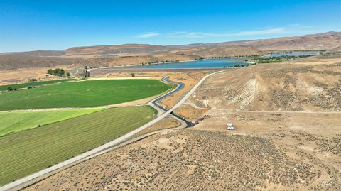
Industrial land
Vale, OR 97918
Entity Owned
7-yr Hold
Free & Clear
Property ID
US71-1150090
Property profile
Verified
Property type
Industrial land
Use group
INDUSTRIAL - VACANT LAND
Lot
0.03 ac (1,438 SF)
Zoning code
V-I
APN
18S4520CC 105
UPID
US71-1150090
Cap rate & NOI
Priority signal for investors
Implied cap rate, NOI & suggested price
Cap rate vs submarket · NOI estimate · 3 price anchors
Implied cap rate, NOI & suggested price
Cap vs submarket · NOI estimate · 3 price anchors
Value estimations
Realmo proprietary · 4 methods
AI Approach
AI
by Request
CAP Approach
CAP
by Request
Comparable Approach
Comparable
by Request
Blend (final)
Blend
by Request
Owner & transaction history
Dentinger Feed & Seed Co INC · 7 yrs held
Dentinger Feed & Seed Co INC
since 2019
3 recorded transactions
Zoning & alternative use
V-I · Vale, OR
Permitted uses
Permitted uses
Allowed · conditional · prohibited
Zoning description
The purpose of V-I district is to allow uses such as wholesale distribution, service station and manufacturing, repairing, fabricating, processing or packaging
Zone name
Light Industrial
General category
INDUSTRIAL
Zone area
249.58 ac
Source
Realmo
Cap rate
Implied · in-place · derived from last sale + estimated NOI
Implied Cap rate
#1
Implied · in-place · NOI ÷ last sale
In-place · derived from last sale + estimated NOI
Cap rate, NOI & submarket benchmark
Implied cap rate vs Vale submarket · NOI estimate · Typical band, median & reading
Implied cap rate, NOI & submarket benchmark
Cap vs Vale submarket · NOI estimate · typical band, median & reading
Refine your cap rate
8-question underwriting flow
1.
Property current status — Going-In vs Stabilized
2.
Price for denominator — asking / offer / market
3.
Leasing status & lease structure (NNN / Gross)
4.
Tenant risk profile & vacancy assumption
5.
Upload T12 / rent roll / OM (optional)
Refine in 60 seconds, get exact suggested price
T12 upload · Submarket benchmarks · Sensitivity grid
Suggested price · 3 cap rate anchors
Income approach @ 5% / 7% / 9% — aggressive / typical / conservative
Suggested price at 5% / 7% / 9% cap
Aggressive / typical / conservative · Implied $/SF per anchor · Sensitivity grid
Suggested price at 5% / 7% / 9% cap
Aggressive / typical / conservative · implied $/SF · sensitivity
Value
AI, CAP & Alternative Use estimations · Realmo proprietary blendValue Estimations
Based on Realmo’s proprietary methodology
AI Approach
CAP Approach
Comparable Approach
Alternative Use
Get a detailed, property-specific estimation — fast and free
Price per SF
Sale + rent benchmarks
Subject property
—
Submarket sale & rent benchmarks
Median sale $/SF · Asking & closed rent · Submarket vacancy
Submarket sale & rent benchmarks
Median sale $/SF · asking & closed rent · submarket vacancy
Property tax & assessments
Tax year 2023Property tax & assessments
Tax year 2023
Tax billed
$48
Tax year 2023
Assessed value
$2,904
Assessed 2023
Previous assessed
$2,820
+3.0% YoY
Effective rate
1.65%
On assessed value
Assessed land
$2,904
Land market value
$3,020
Total market value
$3,020
Applied tax rate
3.0000
Comparables
6 recent transactions · within 1.5 miComparable in this city
6 recent transactions
Comparable in this City


Similar Nearby for Sale


Recent comparable sales
Sale price & price/SF · Sale date & distance · Adjustments & confidence
Recent comparable sales
Sale price & $/SF · sale date & distance · adjustments
Property description
Physical attributes from public recordsBuilding & lot
Public records
Property type
Industrial land
Use group
INDUSTRIAL - VACANT LAND
Status
Off-Market
Heating
NONE
Lot
0.03 ac (1,438 SF)
Zoning code
V-I
APN
18S4520CC 105
UPID
US71-1150090
Jurisdiction
MALHEUR
Zoning & alternative use
V-I · Vale, ORZoning V-I · permitted uses
V-I · Vale, OR
Permitted & conditional uses
Allowed uses · Special-permit conditions · Prohibited uses
Permitted & conditional uses
Allowed · special-permit conditions · prohibited
Zoning description
The purpose of V-I district is to allow uses such as wholesale distribution, service station and manufacturing, repairing, fabricating, processing or packaging
Zone name
Light Industrial
General category
INDUSTRIAL
Zone area
249.58 ac
Source
Realmo
Building & site characteristics
From public records
Heating
NONE
Lot
0.03 ac
Current owner
From public records · entity-resolved
Dentinger Feed & Seed Co INC
Entity
Free & Clear · 7 yrs held
Mailing address
PO BOX 688, VALE, OR 97918-0688
Mailing matches property
Yes
Owner-occupied
Yes
Ownership since
2019
Owner contacts — direct phone, email, and related entities
Decision-maker phone · Verified email · Related entities & filings
Owner contacts
Email · phone · related entities
Sales History
3 recorded events · public records
Date
Price
Buyer
Seller
Deed Type
Mortgage
May 1, 2019
$83,400
Dentinger Feed & Seed Co INC
County Of Malheur
Quit Claim Deed
related
—
Oct 24, 2014
—
Malheur County
Judith Solorio
Foreclosure
related
—
Jun 15, 2005
$1,660
Richard O Carter
Malheur County
Bargain And Sale Deed
—
Coming soon
Costs & Benchmarks
Operating expenses, capex projections, utility benchmarks, and submarket comparables — all in one view.
Coming soon
Risks
Flood, climate, environmental, title, and tenant-concentration risk — surfaced with mitigations and source citations.
Try Rey
Ask anything about this address in plain English.
“Is 15.6% cap rate sustainable?” · “Best tenant mix for BU1?” · “What’s the redev upside?”
Own this property?
List it free. Reach 20,000 daily buyers.
We’ve already pulled the facts. Confirm photos + price and you’re live in 2 minutes.
List this address →
Full reports are paid
Unlock the full Property Analytics report
Start free for 7 days — no card required. Full owner contacts, all 4 valuations with methodology, refine flow, comparable adjustments, foot-traffic deep dive, export to PDF / CSV.


