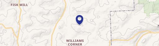
Uppr Podunk Rd Rd New Milford, PA 18834
Property profile & analytics
Uppr Podunk Rd Rd, New Milford, PA 18834
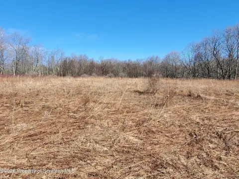
- Mining land & claims
- 15.35 lot acres
Property ID
US73-4963581
The Realmo ID is a unique identifier assigned to every property, incorporating country codes and precise geo-coordinates for 300x300-foot land blocks. It enables standardized data collection and seamless integration of disparate sources such as ownership, tax, title data and physical specifications. By aggregating current and historical records, the Realmo ID powers advanced analytics and delivers deep, verifiable insights for real estate professionals.
Location Intelligence
Current Use by Public Records
- Mining land & claims
Property Details for Uppr Podunk Rd Rd
- Lot size
- 15.35 lot acres
- Property type
- Mining land & claims
- APN
- 167.00-2,034.00,000.
- APU
- 16700203400000
Sales History
| Date | Price | Buyer | Seller | Deed Type | Mortgage |
|---|---|---|---|---|---|
| Aug 18, 2008 | $45,000 | Edward J Kozlowski | Stephen Schlasta JR | Deed | — |
Value Estimations
based on Realmo’s proprietary methodology
-
AI approach
-
CAP approach
-
Comparable approach
-
Alternative Use
Get a detailed, property-specific estimation — fast and free
Location Insight
- Map
- Local Demand
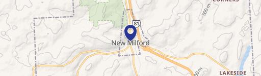
- City
- New Milford
- County
- Susquehanna
- State
- Pennsylvania
- Longitude
- -75.6751
- Latitude
- 41.7687
Property Tax & Assessments
Tax date
Tax Amount
Assessed Land Value
Assessed Improvement Value
Total Assessed Value
Applied Tax Rate
Land Market Value
Improvement Market Value
Total Market Value
2024
$887
$12,100
$1,500
$13,600
-
$24,200
$3,000
$27,200