Trinity St Newton, NJ 07860
T-5 - Town Core Support Area/Neighborhood Cores. The T-5 Transect Zone covers the area surrounding the Town Core that provides the majority of the housing and employment that directly supports the Town Core. The T-5 Transect also provides for Neighborhood Cores to serve some of the neighborhoods which are closer to the Town Core area. The permitted uses in t…
Cap rate
Implied · in-place · derived from last sale + estimated NOIValue
AI, CAP & Alternative Use estimations · Realmo proprietary blendProperty tax & assessments
Tax year 2023Comparables
6 recent transactions · within 1.5 miComparable in this City


Similar Nearby for Sale


Similar Nearby for Lease

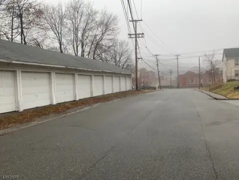


Property description
Physical attributes from public recordsZoning & alternative use
T-5 · Newton, NJT-5 - Town Core Support Area/Neighborhood Cores. The T-5 Transect Zone covers the area surrounding the Town Core that provides the majority of the housing and employment that directly supports the Town Core. The T-5 Transect also provides for Neighborhood Cores to serve some of the neighborhoods which are closer to the Town Core area. The permitted uses in the T-5 Transect generally include mixed-use, hotels, offices and multifamily buildings. (6) T-6 - Town Core. The T-6 Transect is a higher density, mixed and multiple use downtown area. This area provides for the majority of retail and commercial uses within the Town and should be identified as the Central Business District within the Town. This area has residential and office uses over the commercial uses to support day and evening uses in the downtown. (7) Special District 1: Hospital District - SD-1 covers the Newton Medical Center and support services for the hospital. The district is intended for hospital and medical uses and offices. (8) Special District 2: College District - SD-2 covers the Sussex County Community College campus. The district is intended for a college use and college support services. Student housing is permitted. (9) Special District 3: Retail/Manufacturing District - SD-3 covers the area along US Route 206 at its intersection with North and South Park Drive. This area includes existing large-scale retail and industrial uses. The area has potential to accept relocated light manufacturing and industrial uses which currently exist in redevelopment areas. (10) Special District 4: Industrial/Manufacturing District - SD-4 covers the existing industrial site and adjacent lands along and across from Sparta Avenue. This area includes an existing manufacturing facility and has potential for additional manufacturing and light industrial development to provide industries and employment within the Town. This area also has potential to accept relocated light manufacturing and industrial uses which currently exist in redevelopment areas. Where proposed development abuts residential areas, year-round buffers should be provided. (11) Special District 5: Office/Manufacturing District - SD-5 covers the Sparta Avenue redevelopment area, where office, light industrial and manufacturing uses are permitted. (12) Special District 6: Schools District - SD-6 covers the Newton High School, Halsted Street School and Merriam Avenue Elementary School. The district is intended for school uses and support services.
No recorded transactions found for this property.
Costs & Benchmarks
Operating expenses, capex projections, utility benchmarks, and submarket comparables — all in one view.
Risks
Flood, climate, environmental, title, and tenant-concentration risk — surfaced with mitigations and source citations.


