Stringtown Rd Grove City, OH 43123
Property profile & analytics
Stringtown Rd, Grove City, OH 43123
- Gas stations
- 0.85 lot acres
Property ID
US66-4372162
The Realmo ID is a unique identifier assigned to every property, incorporating country codes and precise geo-coordinates for 300x300-foot land blocks. It enables standardized data collection and seamless integration of disparate sources such as ownership, tax, title data and physical specifications. By aggregating current and historical records, the Realmo ID powers advanced analytics and delivers deep, verifiable insights for real estate professionals.
Location Intelligence
Current Use by Public Records
- Gas stations
Property Details for Stringtown Rd
- Lot size
- 0.85 lot acres
- Property type
- Gas stations
- APN
- 040-015155
- APU
- 40015155
Sales History
| Date | Price | Buyer | Seller | Deed Type | Mortgage |
|---|---|---|---|---|---|
| Jan 10, 2022 | — | Grove City Plaza Lpan Ohio LP | — | Deed · related | $5.5M · American Memorial Life Insurance Co |
| Jan 7, 2022 | — | Grove City Plaza LP | — | Deed · related | $5.5M · Cmfg Life Insurance Co |
| — | — | Grove City Plaza LP | — | Deed Of Trust · related | $24.3M · Miscellaneous Ins Co |
| — | — | Grove City Plaza LP | — | Loan Modification · related | $34.7M · Miscellaneous Ins Co |
Value Estimations
based on Realmo’s proprietary methodology
-
AI approach
-
CAP approach
-
Comparable approach
-
Alternative Use
Get a detailed, property-specific estimation — fast and free
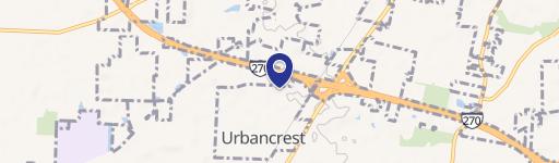
Location Insight
- Map
- Local Demand
- City
- Grove City
- County
- Franklin
- State
- Ohio
- Longitude
- -83.0681
- Latitude
- 39.8816
- CBSA code
- 18140
- CBSA name
- COLUMBUS, OH METROPOLITAN STATISTICAL AREA
Property Tax & Assessments
Tax date
Tax Amount
Assessed Land Value
Assessed Improvement Value
Total Assessed Value
Applied Tax Rate
Land Market Value
Improvement Market Value
Total Market Value
2023
$12,843
$140,110
$30,870
$170,980
-
$400,300
$88,200
$488,500