Mt Tabor Rd New Albany, IN 47150
Property profile & analytics
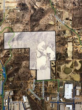
Mt Tabor Rd, New Albany, IN 47150
- Industrial land
- 3.16 lot acres
Property ID
US31-2545604
The Realmo ID is a unique identifier assigned to every property, incorporating country codes and precise geo-coordinates for 300x300-foot land blocks. It enables standardized data collection and seamless integration of disparate sources such as ownership, tax, title data and physical specifications. By aggregating current and historical records, the Realmo ID powers advanced analytics and delivers deep, verifiable insights for real estate professionals.
Location Intelligence
Current Use by Public Records
- Industrial land
Property Details for Mt Tabor Rd
- Lot size
- 3.16 lot acres
- Property type
- Industrial land
- APN
- 22-05-02-200-326.000-008
- APU
- 220502200326000008
Sales History
| Date | Price | Buyer | Seller | Deed Type | Mortgage |
|---|---|---|---|---|---|
| Sep 11, 2023 | — | Ca Schools Acquisition LLC | Storage 265 LLC | Warranty Deed | — |
| Jun 12, 2017 | — | Storage 265 LLC | Utica Investments LLC | Quit Claim Deed · related | — |
| Nov 15, 2016 | — | New Albany Acquisitions LLC | General Mills Operations LLC | Warranty Deed | — |
Value Estimations
based on Realmo’s proprietary methodology
-
AI approach
-
CAP approach
-
Comparable approach
-
Alternative Use
Get a detailed, property-specific estimation — fast and free
Location Insight
- Map
- Local Demand
- City
- New Albany
- County
- Floyd
- State
- Indiana
- Longitude
- -85.821
- Latitude
- 38.3104
- CBSA code
- 31140
- CBSA name
- LOUISVILLE-JEFFERSON COUNTY, KY-IN METROPOLITAN STATISTICAL AREA
Property Tax & Assessments
Tax date
Tax Amount
Assessed Land Value
Assessed Improvement Value
Total Assessed Value
Applied Tax Rate
Land Market Value
Improvement Market Value
Total Market Value
2023
$183
$6,300
$0.00
$6,300
-
$6,300
$0.00
$6,300