Memorial Blvd, TN
Property profile & analytics
, Memorial Blvd, TN
- Commercial land
- 0.68 lot acres
Property ID
US80-2303317
The Realmo ID is a unique identifier assigned to every property, incorporating country codes and precise geo-coordinates for 300x300-foot land blocks. It enables standardized data collection and seamless integration of disparate sources such as ownership, tax, title data and physical specifications. By aggregating current and historical records, the Realmo ID powers advanced analytics and delivers deep, verifiable insights for real estate professionals.
Location Intelligence
Current Use by Public Records
- Commercial land
Property Details
- Lot size
- 0.68 lot acres
- Property type
- Commercial land
- APN
- 074103 00700
- APU
- 7410300700
Sales History
| Date | Price | Buyer | Seller | Deed Type | Mortgage |
|---|---|---|---|---|---|
| Feb 5, 2018 | — | Sumner Mg LLC | — | Loan Modification · related | $1.9M · Pinnacle Bk |
| Nov 14, 2014 | — | Sumner Mg LLC | — | Grant Deed · related | $2.1M · Pinnacle Bk |
| Apr 16, 2010 | — | Hendersonville Memory Gardens | — | Deed Of Trust · related | $2M · Crowe Eugene S M D Tr (pt) |
| Jan 6, 2005 | $82,024 | Citadel Of Middle Tennessee LLC | Alderwoods Tennessee INC | Grant Deed | — |
Value Estimations
based on Realmo’s proprietary methodology
-
AI approach
-
CAP approach
-
Comparable approach
-
Alternative Use
Get a detailed, property-specific estimation — fast and free
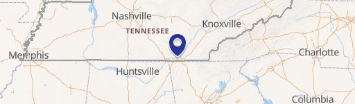
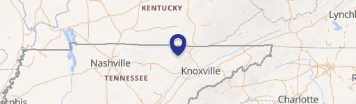
Location Insight
- Map
- Local Demand
- City
- Memorial Blvd
- County
- Robertson
- State
- Tennessee
- Longitude
- -86.854
- Latitude
- 36.4743
- CBSA code
- 34980
- CBSA name
- NASHVILLE-DAVIDSON--MURFREESBORO--FRANKLIN, TN METROPOLITAN STATISTICAL AREA
Property Tax & Assessments
Tax date
Tax Amount
Assessed Land Value
Assessed Improvement Value
Total Assessed Value
Applied Tax Rate
Land Market Value
Improvement Market Value
Total Market Value
0
$0.00
$11,600
$0.00
$11,600
-
$29,000
$0.00
$29,000