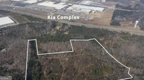
Kia Pkwy West Point, GA 31833
Property profile & analytics
Kia Pkwy, West Point, GA 31833
- Industrial land
- 45.50 lot acres
Property ID
US22-2775487
The Realmo ID is a unique identifier assigned to every property, incorporating country codes and precise geo-coordinates for 300x300-foot land blocks. It enables standardized data collection and seamless integration of disparate sources such as ownership, tax, title data and physical specifications. By aggregating current and historical records, the Realmo ID powers advanced analytics and delivers deep, verifiable insights for real estate professionals.
Location Intelligence
Current Use by Public Records
- Industrial land
Property Details for Kia Pkwy
- Lot size
- 45.50 lot acres
- Zone code
- 17-I-1
- Property type
- Industrial land
- APN
- 0944 000002
- APU
- 944000002
Sales History
| Date | Price | Buyer | Seller | Deed Type | Mortgage |
|---|---|---|---|---|---|
| Mar 26, 2024 | $2,030,000 | West Point Park LLC | Hartley Bridge Development Co LLC | Limited Warranty Deed | — |
| Apr 27, 2022 | $1,400,000 | Hartley Bridge Development Co LLC | J & H Homeplace LLC | Limited Warranty Deed | — |
| Nov 5, 2019 | — | J & H Homeplace LLC | Lura H Hammock | Quit Claim Deed · related | — |
| Jul 7, 2016 | $425,000 | Kia West Point LLC | Harrell,roy W JR & Frank C JR | Warranty Deed | $287k · Bank Of Dudley |
| Jul 7, 2016 | — | Roy W Harrell JR | Cole,verne H | Affidavit Of Death · related | — |
| Nov 9, 2012 | — | Frank Harrell | Harrell,frank | Quit Claim Deed · related | — |
| Sep 12, 2012 | — | Frank Colville Harrell JR. | Harrell,frank C | Quit Claim Deed · related | — |
| Dec 29, 2006 | — | Vivian H Harrell | Harrell,frank C Etal | Quit Claim Deed · related | — |
Value Estimations
based on Realmo’s proprietary methodology
-
AI approach
- Method
- Estimation
- Statistic approach
- $2,030,000
- ML approach
- $2,030,000
Get a detailed, property-specific estimation — fast and free
Location Insight
- Map
- Local Demand
- City
- West Point
- County
- Troup
- State
- Georgia
- Longitude
- -85.152
- Latitude
- 32.8809
- CBSA code
- 29300
- CBSA name
- LAGRANGE, GA-AL MICROPOLITAN STATISTICAL AREA
Property Tax & Assessments
Tax date
Tax Amount
Assessed Land Value
Assessed Improvement Value
Total Assessed Value
Applied Tax Rate
Land Market Value
Improvement Market Value
Total Market Value
2023
$4,985
$145,600
$0.00
$145,600
-
$364,000
$0.00
$364,000