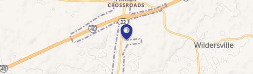
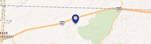
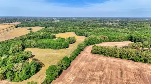
Hwy 22nd N Wildersville, TN 38388
Property profile & analytics
Hwy 22nd N, Wildersville, TN 38388
- Commercial land
- 0.20 lot acres
Property ID
US80-2265829
The Realmo ID is a unique identifier assigned to every property, incorporating country codes and precise geo-coordinates for 300x300-foot land blocks. It enables standardized data collection and seamless integration of disparate sources such as ownership, tax, title data and physical specifications. By aggregating current and historical records, the Realmo ID powers advanced analytics and delivers deep, verifiable insights for real estate professionals.
Location Intelligence
Current Use by Public Records
- Commercial land
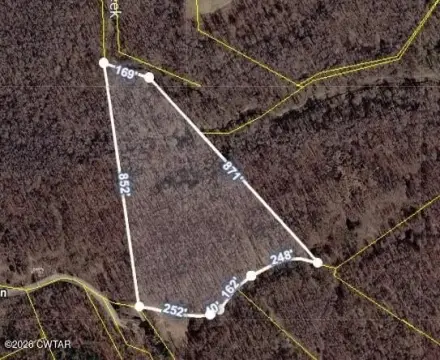
Property Details for Hwy 22nd N
- Lot size
- 0.20 lot acres
- Zone code
- C1
- Property type
- Commercial land
- APN
- 039022 04017
- APU
- 3902204017
Sales History
| Date | Price | Buyer | Seller | Deed Type | Mortgage |
|---|---|---|---|---|---|
| Feb 3, 2010 | $250,000 | Dorris,percy C & Norma L | Coffey,john | Warranty Deed | $213k · Firstbank/w Mi |
| May 26, 2005 | $241,500 | Coffey,john | Mcdaniel,eddie | Warranty Deed | — |
| Jul 14, 2003 | $190,530 | Eddie Mcdaniel | Reeves Brothers | Grant Deed | — |
| — | — | Percy C Dorris | — | Deed Of Trust · related | $80k · Firstbank NA |
| — | — | Percy C Dorris | — | Deed Of Trust · related | $80k · Firstbank NA |
| — | — | Coffey,john | — | Deed Of Trust · related | $51k · Firstbank/w Mi |
Value Estimations
based on Realmo’s proprietary methodology
-
AI approach
-
CAP approach
-
Comparable approach
-
Alternative Use
Get a detailed, property-specific estimation — fast and free
Location Insight
- Map
- Local Demand
- City
- Wildersville
- County
- Henderson
- State
- Tennessee
- Longitude
- -88.3913
- Latitude
- 35.7829
Property Tax & Assessments
Tax date
Tax Amount
Assessed Land Value
Assessed Improvement Value
Total Assessed Value
Applied Tax Rate
Land Market Value
Improvement Market Value
Total Market Value
2022
$40
$2,120
$0.00
$2,120
-
$5,300
$0.00
$5,300