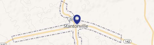
Hwy 142 Stantonville, TN 38379
Property profile & analytics
Hwy 142, Stantonville, TN 38379
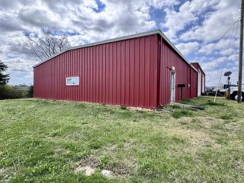
- Retail space
- 1,704 SF
Property ID
US80-2373455
The Realmo ID is a unique identifier assigned to every property, incorporating country codes and precise geo-coordinates for 300x300-foot land blocks. It enables standardized data collection and seamless integration of disparate sources such as ownership, tax, title data and physical specifications. By aggregating current and historical records, the Realmo ID powers advanced analytics and delivers deep, verifiable insights for real estate professionals.
Location Intelligence
Current Use by Public Records
- Retail space
Property Details for Hwy 142
- Year built
- 1966
- Property type
- Retail space
- APN
- 055093 04100
- APU
- 5509304100
Sales History
| Date | Price | Buyer | Seller | Deed Type | Mortgage |
|---|---|---|---|---|---|
| Jun 20, 2023 | $100,000 | A2 Development LLC | Maxwell Valley Properties LLC | Warranty Deed | $550k · Isaacson Holdings LLC |
| Sep 25, 2015 | $90,000 | Maxwell Valley LLC | Cullifer,edward V & Patricia | Warranty Deed | — |
| Sep 4, 2007 | $130,000 | Edward V Cullifer | Rankin,jason K & Martha | Warranty Deed | — |
| — | — | Edward V Cullifer | — | Loan Modification · related | $125k · Hardin Cnty Bk |
| — | — | Edward V Cullifer | — | Deed Of Trust · related | $116k · Hardin Cnty Bk |
Value Estimations
based on Realmo’s proprietary methodology
-
AI approach
-
CAP approach
-
Comparable approach
-
Alternative Use
Get a detailed, property-specific estimation — fast and free
Location Insight
- Map
- Local Demand
- City
- Stantonville
- County
- Mcnairy
- State
- Tennessee
- Longitude
- -88.4234
- Latitude
- 35.159
Property Tax & Assessments
Tax date
Tax Amount
Assessed Land Value
Assessed Improvement Value
Total Assessed Value
Applied Tax Rate
Land Market Value
Improvement Market Value
Total Market Value
2022
$620
$2,400
$36,920
$39,320
-
$6,000
$92,300
$98,300