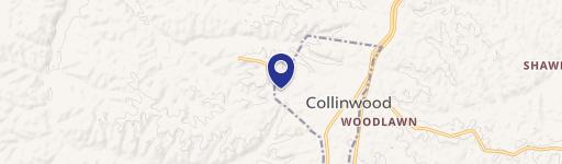
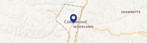
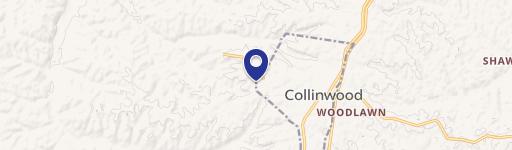
Hwy 13th S Collinwood, TN 38450
Property profile & analytics
Hwy 13th S, Collinwood, TN 38450
- Manufacturing properties
- 64,580 SF
- 6.84 lot acres
Property ID
US80-2363192
The Realmo ID is a unique identifier assigned to every property, incorporating country codes and precise geo-coordinates for 300x300-foot land blocks. It enables standardized data collection and seamless integration of disparate sources such as ownership, tax, title data and physical specifications. By aggregating current and historical records, the Realmo ID powers advanced analytics and delivers deep, verifiable insights for real estate professionals.
Location Intelligence
Current Use by Public Records
- Manufacturing properties
Property Details for Hwy 13th S
- Year built
- 1960
- Construction
- FRAME
- Lot size
- 6.84 lot acres
- Property type
- Manufacturing properties
- APN
- 091137N A 02300
- APU
- 091137NA02300
Sales History
| Date | Price | Buyer | Seller | Deed Type | Mortgage |
|---|---|---|---|---|---|
| Aug 9, 2021 | $250,000 | Hassell & Hughes Lumber Company INC | County Of Wayne | Deed | — |
| Sep 16, 2010 | $15,000 | Wayne Cnty Bk | Dixon,brent | Grant Deed · related | — |
| Apr 10, 2008 | $15,015 | Brent Dixon | Wayne County Tennessee | Warranty Deed | — |
| Sep 11, 2007 | $1,000 | American Legion Post 254/colli | Wayne County Tennessee | Warranty Deed · related | — |
Value Estimations
based on Realmo’s proprietary methodology
-
AI approach
-
CAP approach
-
Comparable approach
-
Alternative Use
Get a detailed, property-specific estimation — fast and free
Location Insight
- Map
- Local Demand
- City
- Collinwood
- County
- Wayne
- State
- Tennessee
- Longitude
- -87.7426
- Latitude
- 35.1675
Property Tax & Assessments
Tax date
Tax Amount
Assessed Land Value
Assessed Improvement Value
Total Assessed Value
Applied Tax Rate
Land Market Value
Improvement Market Value
Total Market Value
0
$0.00
$17,800
$135,400
$153,200
-
$44,500
$338,500
$383,000