Gresham Hwy Vermontville, MI 49096
Property profile & analytics
Gresham Hwy, Vermontville, MI 49096
- Commercial real estate
- 21.67 lot acres
Property ID
US43-3441403
The Realmo ID is a unique identifier assigned to every property, incorporating country codes and precise geo-coordinates for 300x300-foot land blocks. It enables standardized data collection and seamless integration of disparate sources such as ownership, tax, title data and physical specifications. By aggregating current and historical records, the Realmo ID powers advanced analytics and delivers deep, verifiable insights for real estate professionals.
Location Intelligence
Current Use by Public Records
- Commercial real estate
Property Details for Gresham Hwy
- Lot size
- 21.67 lot acres
- Zone code
- LA
- Property type
- Commercial real estate
- APN
- 050 023 100 001 09
- APU
- 5002310000109
Sales History
| Date | Price | Buyer | Seller | Deed Type | Mortgage |
|---|---|---|---|---|---|
| Mar 14, 2023 | — | Robert Cook Reinhart | John D Anderson | Land Contract | — |
| Jun 15, 2017 | $71,500 | John D Anderson | Bryan J Carpenter | Warranty Deed | $54k · Greenstone Farm Credit Services Flc |
Value Estimations
based on Realmo’s proprietary methodology
-
AI approach
-
CAP approach
-
Comparable approach
-
Alternative Use
Get a detailed, property-specific estimation — fast and free
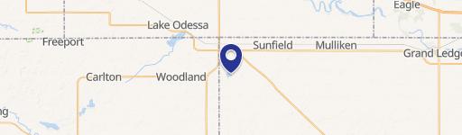
Location Insight
- Map
- Local Demand
- City
- Vermontville
- County
- Eaton
- State
- Michigan
- Longitude
- -84.989
- Latitude
- 42.6352
- CBSA code
- 29620
- CBSA name
- LANSING-EAST LANSING, MI METROPOLITAN STATISTICAL AREA
Property Tax & Assessments
Tax date
Tax Amount
Assessed Land Value
Assessed Improvement Value
Total Assessed Value
Applied Tax Rate
Land Market Value
Improvement Market Value
Total Market Value
2023
$1,802
$0.00
$0.00
$45,000
-
$0.00
$0.00
$90,000