Faye Dr Heath, OH 43056
Property profile & analytics
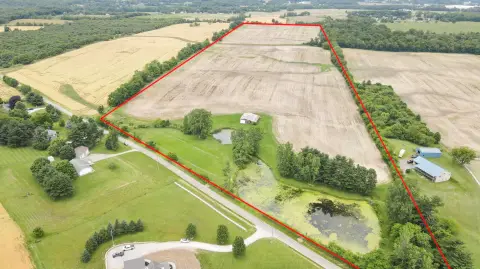
Faye Dr, Heath, OH 43056
- Warehouses
- 9,950 SF
- 0.72 lot acres
Property ID
US66-4549739
The Realmo ID is a unique identifier assigned to every property, incorporating country codes and precise geo-coordinates for 300x300-foot land blocks. It enables standardized data collection and seamless integration of disparate sources such as ownership, tax, title data and physical specifications. By aggregating current and historical records, the Realmo ID powers advanced analytics and delivers deep, verifiable insights for real estate professionals.
Location Intelligence
Current Use by Public Records
- Warehouses
Property Details for Faye Dr
- Year built
- 2010
- Lot size
- 0.72 lot acres
- Property type
- Warehouses
- Property subtype
- Self storage facilities
- APN
- 030-091536-00.000
- APU
- 3009153600000
Sales History
| Date | Price | Buyer | Seller | Deed Type | Mortgage |
|---|---|---|---|---|---|
| Feb 13, 2026 | — | West Main Warehouses LLC | Coffman Faye Warehouse LLC | Quitclaim Deed · related | — |
| May 21, 2020 | — | West Main Warehouses LLC | — | Deed · related | $4.7M · Park Nat'l Bk |
| Jul 25, 2014 | — | Coffman Faye Warehouse LLC | Correll,michael S & Sharon S | Warranty Deed | — |
| Jul 22, 2008 | $110,000 | Michael E Correll | Dow Chemical | Quit Claim Deed · related | — |
| — | — | Michael S Correll | — | Deed Of Trust · related | $950k · Park National Bank |
| — | — | West Main Warehouses LLC | — | Deed Of Trust · related | $4.7M · Park Nat'l Bk |
Value Estimations
based on Realmo’s proprietary methodology
-
Comparable approach
- Method
- Estimation
- Statistic Estimate
- $664,000
- AI Estimate
- $501,000
Market price range: $294k - $775kMarket price range: $214k - $669k -
Alternative Use
- Use
- Estimation
- WAREHOUSE, STORAGE
- $555,000 Current use
- OFFICE BUILDING
- $1,000,000 Change: +80% Conversion: Difficult
- AUTO REPAIR, GARAGE
- $795,000 Change: +43% Conversion: Easy
- COMMERCIAL (GENERAL)
- $785,000 Change: +42% Conversion: Difficult
- RETAIL STORES
- $725,000 Change: +31% Conversion: Moderate
Get a detailed, property-specific estimation — fast and free
Location Insight
- Map
- Local Demand
- City
- Heath
- County
- Licking
- State
- Ohio
- Longitude
- -82.4704
- Latitude
- 40.0354
- CBSA code
- 18140
- CBSA name
- COLUMBUS, OH METROPOLITAN STATISTICAL AREA
Property Tax & Assessments
Tax date
Tax Amount
Assessed Land Value
Assessed Improvement Value
Total Assessed Value
Applied Tax Rate
Land Market Value
Improvement Market Value
Total Market Value
2023
$4,901
$17,080
$237,370
$254,450
-
$48,800
$678,200
$727,000