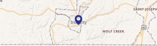
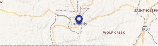
Corning Rd Iron City, TN 38463
Property profile & analytics
Corning Rd, Iron City, TN 38463
- Manufacturing properties
- 105,020 SF
- 8.20 lot acres
Property ID
US80-2166499
The Realmo ID is a unique identifier assigned to every property, incorporating country codes and precise geo-coordinates for 300x300-foot land blocks. It enables standardized data collection and seamless integration of disparate sources such as ownership, tax, title data and physical specifications. By aggregating current and historical records, the Realmo ID powers advanced analytics and delivers deep, verifiable insights for real estate professionals.
Location Intelligence
Current Use by Public Records
- Manufacturing properties
Property Details for Corning Rd
- Year built
- 1970
- Construction
- FRAME
- Lot size
- 8.20 lot acres
- Property type
- Manufacturing properties
- APN
- 050170 01404
- APU
- 5017001404
Sales History
| Date | Price | Buyer | Seller | Deed Type | Mortgage |
|---|---|---|---|---|---|
| Apr 10, 2026 | $34,541 | Luker Joshua | Sandusky Trucking INC | Deed | — |
| Dec 14, 2020 | $45,000 | Sandusky Trucking INC | Timothy Purser | Warranty Deed | — |
Value Estimations
based on Realmo’s proprietary methodology
-
AI approach
- Method
- Estimation
- ML approach
- $925,000
-
Comparable approach
- Method
- Estimation
- AI Estimate
- $1,335,000
Market price range: $1.34M - $2.30M -
Alternative Use
- Use
- Estimation
- INDUSTRIAL (GENERAL)
- $1,665,000 Current use
Get a detailed, property-specific estimation — fast and free
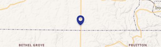
Location Insight
- Map
- Local Demand
- City
- Iron City
- County
- Lawrence
- State
- Tennessee
- Longitude
- -87.5841
- Latitude
- 35.0316
- CBSA code
- 29980
- CBSA name
- LAWRENCEBURG, TN MICROPOLITAN STATISTICAL AREA
Property Tax & Assessments
Tax date
Tax Amount
Assessed Land Value
Assessed Improvement Value
Total Assessed Value
Applied Tax Rate
Land Market Value
Improvement Market Value
Total Market Value
2023
$5,905
$9,840
$283,880
$293,720
-
$24,600
$709,700
$734,300