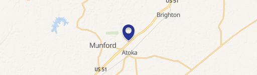
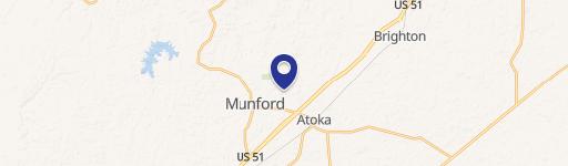
Atoka Munford Ave Munford, TN 38058
Property profile & analytics
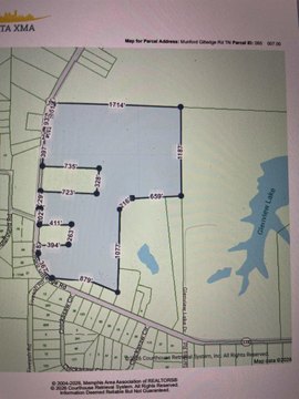
Atoka Munford Ave, Munford, TN 38058
- Commercial land
- 6,063 SF
- 12.55 lot acres
Property ID
US80-2498647
The Realmo ID is a unique identifier assigned to every property, incorporating country codes and precise geo-coordinates for 300x300-foot land blocks. It enables standardized data collection and seamless integration of disparate sources such as ownership, tax, title data and physical specifications. By aggregating current and historical records, the Realmo ID powers advanced analytics and delivers deep, verifiable insights for real estate professionals.
Location Intelligence
Current Use by Public Records
- Commercial land
Property Details for Atoka Munford Ave
- Year built
- 1938
- Lot size
- 12.55 lot acres
- Property type
- Commercial land
- APN
- 084111 01500
- APU
- 8411101500
Sales History
| Date | Price | Buyer | Seller | Deed Type | Mortgage |
|---|---|---|---|---|---|
| Jul 21, 2022 | $250,000 | Atoka Development LLC | Patriot Plaza LLC | Warranty Deed | $250k · Insouth Bank |
| Apr 10, 2012 | $250,000 | Patriot Plaza LLC | Ljld Dev LLC | Warranty Deed | — |
| Jul 10, 2009 | — | Woodlands At Capital Way LLC | Keach,timothy G | Quit Claim Deed · related | — |
| Apr 30, 2009 | $680,000 | Timothy G Keach | Ljld Dev LLC | Warranty Deed | — |
| Jul 10, 2007 | $1,141,620 | Syed H Shirazee | Ljld Development LLC | Warranty Deed | $944k · Patriot Bank NA |
| Jul 26, 2002 | — | Paul Mcdaniel | Gragg,margaret E | Grant Deed · related | — |
Value Estimations
based on Realmo’s proprietary methodology
-
AI approach
-
CAP approach
-
Comparable approach
-
Alternative Use
Get a detailed, property-specific estimation — fast and free
Location Insight
- Map
- Local Demand
- City
- Munford
- County
- Tipton
- State
- Tennessee
- Longitude
- -89.7806
- Latitude
- 35.4447
- CBSA code
- 32820
- CBSA name
- MEMPHIS, TN-MS-AR METROPOLITAN STATISTICAL AREA
Property Tax & Assessments
Tax date
Tax Amount
Assessed Land Value
Assessed Improvement Value
Total Assessed Value
Applied Tax Rate
Land Market Value
Improvement Market Value
Total Market Value
2022
$7,375
$240,240
$0.00
$240,240
-
$600,600
$0.00
$600,600