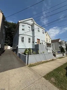
97 Riv Dr Passaic, NJ 07055
Cellular antennas and towers are prohibited in the following zones: R-1, R-2, R-1A, R-3, PD-1, PD-2, PD-3, PD-4, O-R and C-R. [2] Cellular antennas shall be permitted in the following zones: C, M-1 and M-2. [3] Notwithstanding the provisions of Subsections F(2)(c)[1] and [2] herein, no cellular antenna shall be permitted within a two-hundred-foot radius of a…
Cap rate
Implied · in-place · derived from last sale + estimated NOIValue
AI, CAP & Alternative Use estimations · Realmo proprietary blendProperty tax & assessments
Tax year 2022Comparables
6 recent transactions · within 1.5 miComparable in this City


Similar Nearby for Sale


Similar Nearby for Lease


Property description
Physical attributes from public recordsZoning & alternative use
C-R · Passaic, NJCellular antennas and towers are prohibited in the following zones: R-1, R-2, R-1A, R-3, PD-1, PD-2, PD-3, PD-4, O-R and C-R. [2] Cellular antennas shall be permitted in the following zones: C, M-1 and M-2. [3] Notwithstanding the provisions of Subsections F(2)(c)[1] and [2] herein, no cellular antenna shall be permitted within a two-hundred-foot radius of any school, hospital or nursing home. G. Accessory dwelling unit. [Added 3-19-2024 by Ord. No. 2435-24 ] (1) The residence for which the permit is sought shall be a one-family or two-family residence. (2) In no case shall an accessory unit eliminate any of the existing on-site parking on the lot. (3) The accessory dwelling must be located in an attic, basement, ground floor below the primary unit, and/or above a garage. (4) In no case shall the ADU be more than 50% of the living area of a principal dwelling unit, but no less than 300 square feet, nor have more than three bedrooms. (5) The accessory dwelling may not be situated or contained within a cellar. (6) There shall be no more than one accessory dwelling unit per lot. (7) An accessory dwelling unit that is attached to the principal single-family and/or two-family dwelling shall utilize the same exterior materials and colors as the principal dwelling. The ADU shall preserve the physical housing stock and the architectural and landscaping character of residential neighborhoods. (8) The accessory dwelling unit shall be used only for residential purposes. (9) Every accessory dwelling unit must contain a twenty-year deed restricted affordability period: (a) Tenants for each accessory unit cannot exceed the maximum income limits as established annually by the U.S. Department of Housing and Urban Development (HUD). (b) Rents for each accessory unit cannot exceed the rental limits as established annually by the U.S. Department of Housing and Urban Development (HUD). (10) No accessory structure may be built on any lot on which there is no principal building or structure. (11) Accessory structures shall not exceed the maximum height permitted in the zone for a one- and/or two-family structure.
Costs & Benchmarks
Operating expenses, capex projections, utility benchmarks, and submarket comparables — all in one view.
Risks
Flood, climate, environmental, title, and tenant-concentration risk — surfaced with mitigations and source citations.


