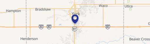
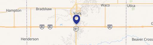
910 Rd 15 York, NE 68467-8050
Property profile & analytics
910 Rd 15, York, NE 68467-8050
- Retail properties & Spaces
- 240 SF
- 158.77 lot acres
Property ID
US57-0277499
The Realmo ID is a unique identifier assigned to every property, incorporating country codes and precise geo-coordinates for 300x300-foot land blocks. It enables standardized data collection and seamless integration of disparate sources such as ownership, tax, title data and physical specifications. By aggregating current and historical records, the Realmo ID powers advanced analytics and delivers deep, verifiable insights for real estate professionals.
Location Intelligence
Current Use by Public Records
- Midwest Research Inc / Agricultural Service / Research Institute
Property Details for 910 Rd 15
- Year built
- 1980
- Lot size
- 158.77 lot acres
- Zone code
- AGRICULTURAL
- Property type
- Retail properties & Spaces
- APN
- 930062884
- APU
- 930062884
Sales History
| Date | Price | Buyer | Seller | Deed Type | Mortgage |
|---|---|---|---|---|---|
| Dec 29, 2008 | — | Spotanski Family Farms LLC | Spotanski Family Farms LLC | Assessor Sales History | — |
Value Estimations
based on Realmo’s proprietary methodology
-
AI approach
-
CAP approach
-
Comparable approach
-
Alternative Use
Get a detailed, property-specific estimation — fast and free
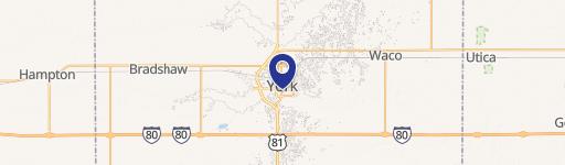
Location Insight
- Map
- Local Demand
- City
- York
- County
- York
- State
- Nebraska
- Longitude
- -97.6689
- Latitude
- 40.905
Property Tax & Assessments
Tax date
Tax Amount
Assessed Land Value
Assessed Improvement Value
Total Assessed Value
Applied Tax Rate
Land Market Value
Improvement Market Value
Total Market Value
2023
$21,785
$1,058,347
$405,335
$1,463,682
-
$1,058,347
$405,335
$1,463,682