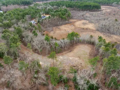
9 Kendrick Rd Wareham, MA 02571-1077
Property profile & analytics
9 Kendrick Rd, Wareham, MA 02571-1077
- Warehouses
- 39,960 SF
- 3.00 lot acres
Property ID
US38-1389077
The Realmo ID is a unique identifier assigned to every property, incorporating country codes and precise geo-coordinates for 300x300-foot land blocks. It enables standardized data collection and seamless integration of disparate sources such as ownership, tax, title data and physical specifications. By aggregating current and historical records, the Realmo ID powers advanced analytics and delivers deep, verifiable insights for real estate professionals.
Location Intelligence
Current Use by Public Records
- Viabella / Advertising Agency / Marketing & Advertising
Property Details for 9 Kendrick Rd
- Year built
- 1981
- Construction
- STEEL FRAME
- Lot size
- 3.00 lot acres
- Property type
- Warehouses
- APN
- WARE M:00108 B:000 L:1006K1
- APU
- WAREM00108B000L1006K1
Sales History
| Date | Price | Buyer | Seller | Deed Type | Mortgage |
|---|---|---|---|---|---|
| Apr 11, 2024 | $3,200,000 | Kendrick Rd Prop Owner Ll | Salkovitz Ft LLC | Quit Claim Arm's Length For Ne States | $2.3M · Savers Cooperative Bank |
| Jun 17, 2021 | — | Salkovitz Ft LLC | Wareham Town Of | Redemption Deed · related | — |
| Aug 20, 2020 | — | Salkovitz LLC | — | Deed · related | $2M · J S Mccarthy Co INC |
| Jul 10, 2018 | — | Salkovitz LLC Trust | — | Deed · related | $830k · J S Mccarthy Co INC |
| Sep 28, 2016 | — | Salkovitz Ft LLC | — | Deed · related | $2M · Crestmark Bank |
| Jun 19, 2015 | $850,000 | Salkovitz Ft LLC | Vabiella Holdings LLC | Foreclosure · related | — |
| Jun 20, 2006 | — | Marian Heath Greeting LLC | — | Deed Of Trust · related | $8.9M · Banknorth NA |
| Jun 29, 2005 | — | Marian Heath Greeting LLC | — | Deed Of Trust · related | $1.8M · Worth Funding INC |
| May 29, 1996 | — | Kendrick Rd RT | — | Deed Of Trust · related | $502k · Fleet National Bank |
| Aug 3, 1990 | — | Kendrick Rd RT Nine | — | Deed Of Trust · related | $407k · Shawmut Bank Of Boston |
| Aug 2, 1988 | — | Kendrick Rd RT Nine | — | Deed Of Trust · related | $125k · First Bristolcty Ofma |
| — | — | Salkovitz LLC Trust | — | Deed Of Trust · related | $830k · J S Mccarthy Co INC |
| — | — | Salkovitz LLC | — | Deed Of Trust · related | $2M · J S Mccarthy Co INC |
Value Estimations
based on Realmo’s proprietary methodology
-
AI approach
- Method
- Estimation
- Statistic approach
- $3,200,000
- ML approach
- $3,200,000
-
Comparable approach
- Method
- Estimation
- Statistic Estimate
- $2,356,000
Market price range: $2.36M - $7.39M -
Alternative Use
- Use
- Estimation
- WAREHOUSE, STORAGE
- $4,665,000 Current use
Get a detailed, property-specific estimation — fast and free
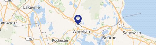
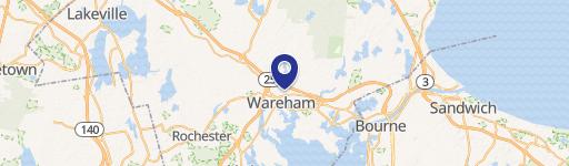
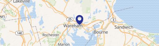
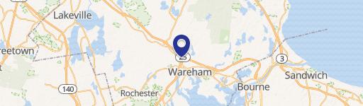
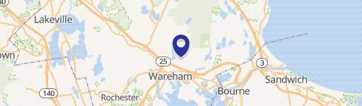
Location Insight
- Map
- Local Demand
- City
- Wareham
- County
- Plymouth
- State
- Massachusetts
- Longitude
- -70.7382
- Latitude
- 41.782
- CBSA code
- 14460
- CBSA name
- BOSTON-CAMBRIDGE-QUINCY, MA-NH METROPOLITAN STATISTICAL AREA
Property Tax & Assessments
Tax date
Tax Amount
Assessed Land Value
Assessed Improvement Value
Total Assessed Value
Applied Tax Rate
Land Market Value
Improvement Market Value
Total Market Value
2024
$22,733
$580,600
$1,443,700
$2,024,300
-
$0.00
$0.00
$0.00