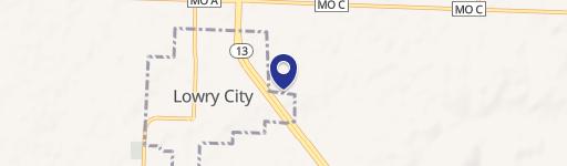
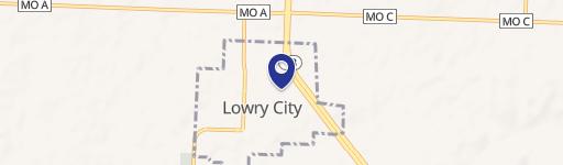
8305 Hwy 13 Lowry City, MO 64763-8201
Property profile & analytics
8305 Hwy 13, Lowry City, MO 64763-8201
- Gas stations
- 5,840 SF
- 2.03 lot acres
Property ID
US48-1692507
The Realmo ID is a unique identifier assigned to every property, incorporating country codes and precise geo-coordinates for 300x300-foot land blocks. It enables standardized data collection and seamless integration of disparate sources such as ownership, tax, title data and physical specifications. By aggregating current and historical records, the Realmo ID powers advanced analytics and delivers deep, verifiable insights for real estate professionals.
Location Intelligence
Current Use by Public Records
- Gas stations
Property Details for 8305 Hwy 13
- Year built
- 2008
- Construction
- FRAME
- Lot size
- 2.03 lot acres
- Property type
- Gas stations
- APN
- 06-4.0-18-003-001-002.01
- APU
- 6401800300100201
Sales History
| Date | Price | Buyer | Seller | Deed Type | Mortgage |
|---|---|---|---|---|---|
| Apr 28, 2021 | — | Lowry Convenience LLC | Makkers Properties LLC | Warranty Deed | $630k · Legacy Bank & Trust |
| Oct 6, 2014 | $900,000 | Makers Properties LLC | Alexander Farms Convenience Stores | Warranty Deed | — |
Value Estimations
based on Realmo’s proprietary methodology
-
AI approach
-
CAP approach
-
Comparable approach
-
Alternative Use
Get a detailed, property-specific estimation — fast and free
Location Insight
- Map
- Local Demand
- City
- Lowry City
- County
- St. Clair
- State
- Missouri
- Longitude
- -93.7216
- Latitude
- 38.1424
Property Tax & Assessments
Tax date
Tax Amount
Assessed Land Value
Assessed Improvement Value
Total Assessed Value
Applied Tax Rate
Land Market Value
Improvement Market Value
Total Market Value
2023
$13,406
$0.00
$0.00
$211,500
-
$6,600
$654,200
$660,800