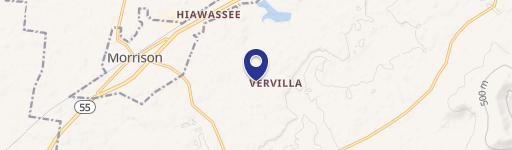
8220 Mcminnville Hwy Morrison, TN 37357-3408
Property profile & analytics
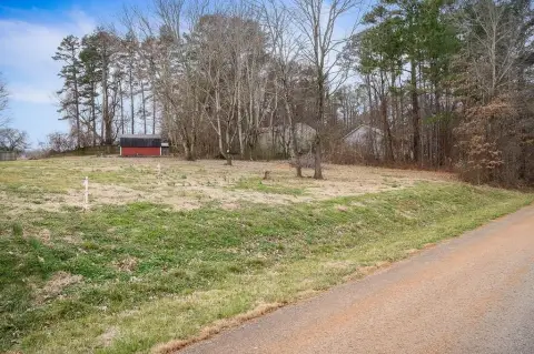
8220 Mcminnville Hwy, Morrison, TN 37357-3408
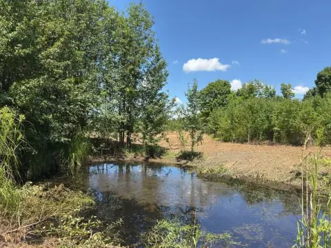
- Commercial land
- 192 SF
- 2.00 lot acres
Property ID
US80-0700936
The Realmo ID is a unique identifier assigned to every property, incorporating country codes and precise geo-coordinates for 300x300-foot land blocks. It enables standardized data collection and seamless integration of disparate sources such as ownership, tax, title data and physical specifications. By aggregating current and historical records, the Realmo ID powers advanced analytics and delivers deep, verifiable insights for real estate professionals.
Location Intelligence
Current Use by Public Records
- Garretson Stone / Building Supply
Property Details for 8220 Mcminnville Hwy
- Year built
- 2008
- Lot size
- 2.00 lot acres
- Property type
- Commercial land
- APN
- 016047 05800
- APU
- 1604705800
Sales History
| Date | Price | Buyer | Seller | Deed Type | Mortgage |
|---|---|---|---|---|---|
| Sep 29, 2022 | — | Frank Garretson JR | David Brown | Correction Deed · related | — |
| Sep 23, 2022 | $200,000 | Frank Garretson JR | David Brown | Warranty Deed | $300k · Coffee County Bank |
| Apr 1, 2019 | — | Roland Properties | Roland Media LLC | Quit Claim Deed · related | — |
| Feb 18, 2003 | $45,000 | Henley | Brown,david & Gl | Grant Deed | — |
Value Estimations
based on Realmo’s proprietary methodology
-
AI approach
-
CAP approach
-
Comparable approach
-
Alternative Use
Get a detailed, property-specific estimation — fast and free
Location Insight
- Map
- Local Demand
- City
- Morrison
- County
- Coffee
- State
- Tennessee
- Longitude
- -85.975
- Latitude
- 35.5528
- CBSA code
- 46100
- CBSA name
- TULLAHOMA, TN MICROPOLITAN STATISTICAL AREA
Property Tax & Assessments
Tax date
Tax Amount
Assessed Land Value
Assessed Improvement Value
Total Assessed Value
Applied Tax Rate
Land Market Value
Improvement Market Value
Total Market Value
2023
$331
$14,200
$0.00
$14,200
-
$35,500
$0.00
$35,500