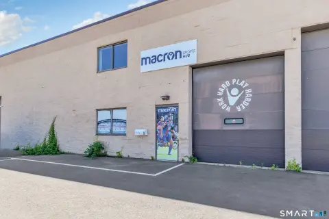
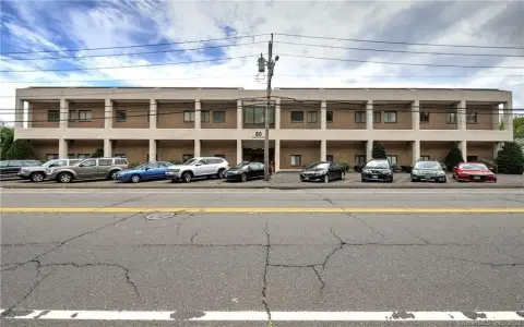
80 Garfield Ave Stratford, CT 06615-7157
Property profile & analytics
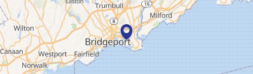
80 Garfield Ave, Stratford, CT 06615-7157
- Warehouses
- 44,104 SF
- 4.19 lot acres
Property ID
US15-0939562
The Realmo ID is a unique identifier assigned to every property, incorporating country codes and precise geo-coordinates for 300x300-foot land blocks. It enables standardized data collection and seamless integration of disparate sources such as ownership, tax, title data and physical specifications. By aggregating current and historical records, the Realmo ID powers advanced analytics and delivers deep, verifiable insights for real estate professionals.
Location Intelligence
Current Use by Public Records
- Stratford Baling Corporation / Waste Management Facility / Hazardous Waste Disposal
- Peter's Rubbish Removal / Waste Management Facility
Property Details for 80 Garfield Ave
- Year built
- 1960
- Construction
- STEEL FRAME
- Lot size
- 4.19 lot acres
- Zone code
- MA
- Property type
- Warehouses
- APN
- STRA M:30-5 B:2 L:12
- APU
- STRAM305B2L12
Sales History
| Date | Price | Buyer | Seller | Deed Type | Mortgage |
|---|---|---|---|---|---|
| Sep 5, 2008 | $3,200,000 | Garfield Avenue Rlty LLC | Berwood Assoc | Warranty Deed | $41M · Bank Of America |
| Sep 2, 2003 | — | Berwood Assoc | — | Deed Of Trust · related | $1M · Hudson United Bank |
| May 1, 2001 | — | Berwood Assoc | — | Deed Of Trust · related | $1.3M · Hudson United Bank |
| Sep 24, 1999 | — | Berwood Assoc | — | Deed Of Trust · related | $520k · Hudson United Bank |
| Jun 30, 1992 | — | Berwood Assoc | — | Deed Of Trust · related | $1.4M · Lafayette Bank & Trust |
| Feb 11, 1987 | — | Berwood Assoc | — | Deed Of Trust · related | $310k · Lafayette Bank & Trust |
Value Estimations
based on Realmo’s proprietary methodology
-
AI approach
- Method
- Estimation
- ML approach
- $585,000
-
Comparable approach
- Method
- Estimation
- AI Estimate
- $1,137,000
Market price range: $423k - $2.06M -
Alternative Use
- Use
- Estimation
- WAREHOUSE, STORAGE
- $1,165,000 Current use
Get a detailed, property-specific estimation — fast and free
Location Insight
- Map
- Local Demand
- City
- Stratford
- County
- Fairfield
- State
- Connecticut
- Longitude
- -73.1474
- Latitude
- 41.1726
- CBSA code
- 14860
- CBSA name
- BRIDGEPORT-STAMFORD-NORWALK, CT METROPOLITAN STATISTICAL AREA
Property Tax & Assessments
Tax date
Tax Amount
Assessed Land Value
Assessed Improvement Value
Total Assessed Value
Applied Tax Rate
Land Market Value
Improvement Market Value
Total Market Value
2023
$92,603
$967,890
$1,335,670
$2,303,560
-
$0.00
$0.00
$0.00