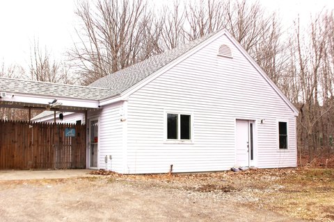
790 Ww St Rockport, ME 04856-5144
Property profile & analytics
790 Ww St, Rockport, ME 04856-5144
- Warehouses
- 2,881 SF
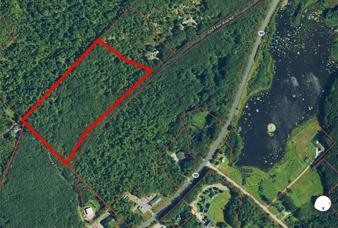
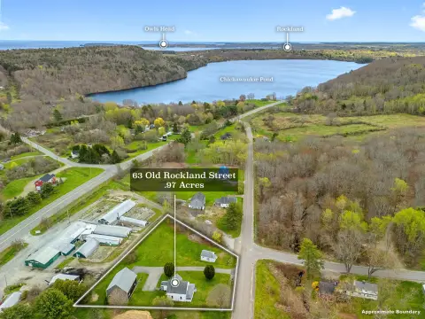
- 0.91 lot acres
Property ID
US42-0040687
The Realmo ID is a unique identifier assigned to every property, incorporating country codes and precise geo-coordinates for 300x300-foot land blocks. It enables standardized data collection and seamless integration of disparate sources such as ownership, tax, title data and physical specifications. By aggregating current and historical records, the Realmo ID powers advanced analytics and delivers deep, verifiable insights for real estate professionals.
Location Intelligence
Current Use by Public Records
- Maritime Farms / Grocery & Convenience Store
Property Details for 790 Ww St
- Year built
- 1960
- Construction
- FRAME
- Lot size
- 0.91 lot acres
- Property type
- Warehouses
- APN
- ROCT M:016 B:061
- APU
- ROCTM016B061
Sales History
| Date | Price | Buyer | Seller | Deed Type | Mortgage |
|---|---|---|---|---|---|
| Dec 29, 2022 | $1,356,717 | Midcoast Me Com Prop LLC | Maritime Energy | Warranty Deed | $1.5M · Bar Harbor Bank & Trust Co |
Value Estimations
based on Realmo’s proprietary methodology
-
AI approach
- Method
- Estimation
- Statistic approach
- $1,390,000
- ML approach
- $1,360,000
Get a detailed, property-specific estimation — fast and free
Location Insight
- Map
- Local Demand
- City
- Rockport
- County
- Knox
- State
- Maine
- Longitude
- -69.1486
- Latitude
- 44.1773
- CBSA code
- 40500
- CBSA name
- ROCKLAND, ME MICROPOLITAN STATISTICAL AREA
Property Tax & Assessments
Tax date
Tax Amount
Assessed Land Value
Assessed Improvement Value
Total Assessed Value
Applied Tax Rate
Land Market Value
Improvement Market Value
Total Market Value
2023
$8,745
$66,600
$624,700
$691,300
-
$0.00
$0.00
$0.00