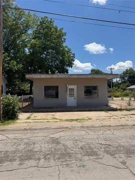
719 Highway 81 S Duncan, OK 73533
Property profile & analytics
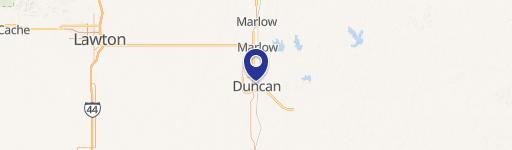
719 Highway 81 S, Duncan, OK 73533
- Grocery and convenience stores
- 2,284 SF
- 0.84 lot acres

Property ID
US69-1993126
The Realmo ID is a unique identifier assigned to every property, incorporating country codes and precise geo-coordinates for 300x300-foot land blocks. It enables standardized data collection and seamless integration of disparate sources such as ownership, tax, title data and physical specifications. By aggregating current and historical records, the Realmo ID powers advanced analytics and delivers deep, verifiable insights for real estate professionals.
Location Intelligence
Current Use by Public Records
- Grocery and convenience stores
Property Details for 719 Highway 81 S
- Year built
- 1970
- Construction
- CONCRETE BLOCKS
- Lot size
- 0.84 lot acres
- Property type
- Grocery and convenience stores
- APN
- 1999-06-01S-07W-4-013-00
- APU
- 19990601S07W401300
Sales History
| Date | Price | Buyer | Seller | Deed Type | Mortgage |
|---|---|---|---|---|---|
| Jan 13, 2025 | $1,350,000 | Tgfuel One LLC | Cc Oklahoma B LLC | Special Warranty Deed | — |
| Jan 4, 2023 | $890,500 | 7e Ok 719 S Hwy 81 Duncan LLC | City Mart Enterprises LLC | Special Warranty Deed | — |
| Mar 9, 2021 | — | City Mart Enterprises LLC | — | Deed · related | $639k · Boc Bank |
| Dec 3, 2019 | $175,000 | City Mart Enterprises LLC | Lynnlee LLC | Warranty Deed | $489k · Boc Bank |
| Oct 25, 2019 | — | Lynnlee LLC | State Of Oklahoma | Quit Claim Deed · related | — |
| Dec 5, 2008 | — | Lynnlee INC | Fred D Stafford | Warranty Deed | — |
Value Estimations
based on Realmo’s proprietary methodology
-
AI approach
- Method
- Estimation
- Statistic approach
- $1,375,000
- ML approach
- $1,390,000
-
Comparable approach
- Method
- Estimation
- AI Estimate
- $968,000
Market price range: $265k - $969k
Get a detailed, property-specific estimation — fast and free
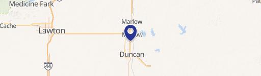
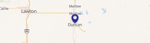
Location Insight
- Map
- Local Demand
- City
- Duncan
- County
- Stephens
- State
- Oklahoma
- Longitude
- -97.9696
- Latitude
- 34.4929
- CBSA code
- 20340
- CBSA name
- DUNCAN, OK MICROPOLITAN STATISTICAL AREA
Property Tax & Assessments
Tax date
Tax Amount
Assessed Land Value
Assessed Improvement Value
Total Assessed Value
Applied Tax Rate
Land Market Value
Improvement Market Value
Total Market Value
2023
$2,884
$6,748
$132,842
$139,590
-
$61,341
$1,207,659
$1,269,000