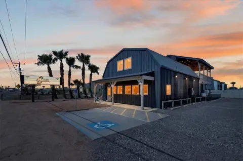
710 State Hwy 361 Port Aransas, TX 78373-5263
Property profile & analytics
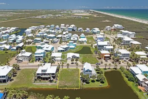
710 State Hwy 361, Port Aransas, TX 78373-5263
- Retail space
- 14,270 SF
- 1.84 lot acres
Property ID
US82-9717476
The Realmo ID is a unique identifier assigned to every property, incorporating country codes and precise geo-coordinates for 300x300-foot land blocks. It enables standardized data collection and seamless integration of disparate sources such as ownership, tax, title data and physical specifications. By aggregating current and historical records, the Realmo ID powers advanced analytics and delivers deep, verifiable insights for real estate professionals.
Location Intelligence
Current Use by Public Records
- Retail space
Property Details for 710 State Hwy 361
- Year built
- 2014
- Lot size
- 1.84 lot acres
- Property type
- Retail space
- APN
- 0220-0001-0010
- APU
- 22000010010
Sales History
| Date | Price | Buyer | Seller | Deed Type | Mortgage |
|---|---|---|---|---|---|
| Jul 24, 2018 | — | Ctc Port Aransas Tx Fee 10268 | Port Aransas Zcf Pharmacy Dst | Quit Claim Deed · related | — |
| Jul 24, 2017 | — | Port Aransas Zcf Pharmacy Dst Trust | — | Deed · related | — |
| Jul 17, 2015 | — | Ecc Cv Port Aransas Tx LLC | Arcp Cv Port Aransas Tx LLC | Grant Deed | — |
| — | — | Port Aransas Zcf Pharmacy Dst Trust | — | Loan Modification · related | — |
Value Estimations
based on Realmo’s proprietary methodology
-
Comparable approach
- Method
- Estimation
- AI Estimate
- $1,319,000
Market price range: $621k - $2.55M -
Alternative Use
- Use
- Estimation
- RETAIL STORES
- $1,775,000 Current use
- INDUSTRIAL (GENERAL)
- $1,830,000 Change: +3% Conversion: Difficult
- AUTO REPAIR, GARAGE
- $1,760,000 Change: -1% Conversion: Difficult
Get a detailed, property-specific estimation — fast and free
Location Insight
- Map
- Local Demand
- City
- Port Aransas
- County
- Nueces
- State
- Texas
- Longitude
- -97.0682
- Latitude
- 27.8282
- CBSA code
- 18580
- CBSA name
- CORPUS CHRISTI, TX METROPOLITAN STATISTICAL AREA
Property Tax & Assessments
Tax date
Tax Amount
Assessed Land Value
Assessed Improvement Value
Total Assessed Value
Applied Tax Rate
Land Market Value
Improvement Market Value
Total Market Value
2023
$47,935
$2,397,671
$1,395,517
$3,793,188
-
$2,397,671
$1,395,517
$3,793,188