Back to Search
Property profile & analytics
OFF-MARKET
Commercial real estate
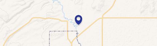
709 Ponderosa Vlg Burns, OR 97720-2315
Individually Owned
4-yr Hold
~
Est. High Equity
Property ID
US71-1077502
Property profile
Verified
Property type
Commercial real estate
Use group
COMMERCIAL (GENERAL)
Year built
1980
Total area
1,220 SF
Lot
0.09 ac (3,920 SF)
Zoning code
CG
APN
23S 30E 13AC 09102
UPID
US71-1077502
Cap rate & NOI
Priority signal for investors
Implied cap rate, NOI & suggested price
Cap rate vs submarket · NOI estimate · 3 price anchors
Implied cap rate, NOI & suggested price
Cap vs submarket · NOI estimate · 3 price anchors
Current use
Occupant on record · Public records
-
Oregon Data Systems Tech Support Center IT Consulting Firm
Value estimations
Realmo proprietary · 4 methods
AI Approach
AI
by Request
CAP Approach
CAP
by Request
Comparable Approach
Comparable
by Request
Blend (final)
Blend
by Request
Owner & transaction history
Edward R Thomas · 4 yrs held
Edward R Thomas
since 2021
Last sale
$125,000
3 recorded transactions
Zoning & alternative use
CG · Burns, OR
Permitted uses
Permitted uses
Allowed · conditional · prohibited
Cap rate
Implied · in-place · derived from last sale + estimated NOI
Implied Cap rate
#1
Implied · in-place · NOI ÷ last sale
In-place · derived from last sale + estimated NOI
Cap rate, NOI & submarket benchmark
Implied cap rate vs Burns submarket · NOI estimate · Typical band, median & reading
Implied cap rate, NOI & submarket benchmark
Cap vs Burns submarket · NOI estimate · typical band, median & reading
Refine your cap rate
8-question underwriting flow
1.
Property current status — Going-In vs Stabilized
2.
Price for denominator — asking / offer / market
3.
Leasing status & lease structure (NNN / Gross)
4.
Tenant risk profile & vacancy assumption
5.
Upload T12 / rent roll / OM (optional)
Refine in 60 seconds, get exact suggested price
T12 upload · Submarket benchmarks · Sensitivity grid
Suggested price · 3 cap rate anchors
Income approach @ 5% / 7% / 9% — aggressive / typical / conservative
Suggested price at 5% / 7% / 9% cap
Aggressive / typical / conservative · Implied $/SF per anchor · Sensitivity grid
Suggested price at 5% / 7% / 9% cap
Aggressive / typical / conservative · implied $/SF · sensitivity
Value
AI, CAP & Alternative Use estimations · Realmo proprietary blendValue Estimations
Based on Realmo’s proprietary methodology
AI Approach
CAP Approach
Comparable Approach
Alternative Use
Get a detailed, property-specific estimation — fast and free
Price per SF
Sale + rent benchmarks
Subject property
—
Submarket sale & rent benchmarks
Median sale $/SF · Asking & closed rent · Submarket vacancy
Submarket sale & rent benchmarks
Median sale $/SF · asking & closed rent · submarket vacancy
Property tax & assessments
Tax year 2023Property tax & assessments
Tax year 2023
Tax billed
$1,166
Tax year 2023
Assessed value
$68,420
Assessed 2023
Previous assessed
$66,430
+3.0% YoY
Effective rate
1.70%
On assessed value
Land market value
$20,340
Improvement market value
$55,380
Total market value
$75,720
Applied tax rate
110.0000
Comparables
6 recent transactions · within 1.5 miComparable in this city
6 recent transactions
Comparable in this City


Similar Nearby for Sale


Recent comparable sales
Sale price & price/SF · Sale date & distance · Adjustments & confidence
Recent comparable sales
Sale price & $/SF · sale date & distance · adjustments
Property description
Physical attributes from public recordsBuilding & lot
Public records
Property type
Commercial real estate
Use group
COMMERCIAL (GENERAL)
Status
Off-Market
Year built
1980
Heating
NONE
Total area
1,220 SF
Lot
0.09 ac (3,920 SF)
Zoning code
CG
APN
23S 30E 13AC 09102
UPID
US71-1077502
Jurisdiction
HARNEY
Zoning & alternative use
CG · Burns, OR
Zoning CG · permitted uses
CG · Burns, OR
Permitted & conditional uses
Allowed uses · Special-permit conditions · Prohibited uses
Permitted & conditional uses
Allowed · special-permit conditions · prohibited
Burns. Always verify with local authorities before improvements.
Building & site characteristics
From public records
Year built
1980
Heating
NONE
Lot
0.09 ac
Current owner
From public records · entity-resolved
Edward R Thomas
Individual
Mailing address
4472 15TH MILE RD, THE DALLES, OR 97058-8625
Ownership since
2021
Owner contacts — direct phone, email, and related entities
Decision-maker phone · Verified email · Related entities & filings
Owner contacts
Email · phone · related entities
Sales History
3 recorded events · public records
Date
Price
Buyer
Seller
Deed Type
Mortgage
Nov 19, 2021
$125,000
Edward R Thomas
Boyce A Laforest
Warranty Deed
$96,000 · First Interstate Bank
Apr 1, 2019
$65,000
Boyce A Laforest
Stephanie J Finlayson
Warranty Deed
$45,000 · Dorothy A Blackburn Family Trust
May 3, 2016
—
Jacob Miller
—
Deed
related
$27,000 · Old West FCU
Coming soon
Costs & Benchmarks
Operating expenses, capex projections, utility benchmarks, and submarket comparables — all in one view.
Coming soon
Risks
Flood, climate, environmental, title, and tenant-concentration risk — surfaced with mitigations and source citations.
Try Rey
Ask anything about this address in plain English.
“Is 15.6% cap rate sustainable?” · “Best tenant mix for BU1?” · “What’s the redev upside?”
You own 709 Ponderosa Vlg?
List it free. Reach 20,000 daily buyers.
We’ve already pulled the facts. Confirm photos + price and you’re live in 2 minutes.
List this address →
Full reports are paid
Unlock the full Property Analytics report
Start free for 7 days — no card required. Full owner contacts, all 4 valuations with methodology, refine flow, comparable adjustments, foot-traffic deep dive, export to PDF / CSV.


