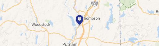
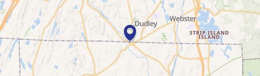
700 Riverside Dr North Grosvenordale, CT 06255-1729
Property profile & analytics
700 Riverside Dr, North Grosvenordale, CT 06255-1729
- Commercial land
- 0.83 lot acres
Property ID
US15-0567060
The Realmo ID is a unique identifier assigned to every property, incorporating country codes and precise geo-coordinates for 300x300-foot land blocks. It enables standardized data collection and seamless integration of disparate sources such as ownership, tax, title data and physical specifications. By aggregating current and historical records, the Realmo ID powers advanced analytics and delivers deep, verifiable insights for real estate professionals.
Location Intelligence
Current Use by Public Records
- Commercial land
Property Details for 700 Riverside Dr
- Lot size
- 0.83 lot acres
- Zone code
- C
- Property type
- Commercial land
- APN
- THOM M:63 B:94A L:1
- APU
- THOMM63B94AL1
Sales History
| Date | Price | Buyer | Seller | Deed Type | Mortgage |
|---|---|---|---|---|---|
| Nov 19, 2008 | — | 549 Riverside Drive LLC | — | Deed Of Trust · related | $175k · Robert Ricci |
| Dec 3, 2003 | $20,000 | Reardon Rd Properties LLC | Flood Realty LLC | Warranty Deed | — |
Value Estimations
based on Realmo’s proprietary methodology
-
AI approach
-
CAP approach
-
Comparable approach
-
Alternative Use
Get a detailed, property-specific estimation — fast and free
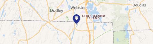
Location Insight
- Map
- Local Demand
- City
- North Grosvenordale
- County
- Windham
- State
- Connecticut
- Longitude
- -71.8972
- Latitude
- 41.9726
- CBSA code
- 49340
- CBSA name
- WORCESTER, MA-CT METROPOLITAN STATISTICAL AREA
Property Tax & Assessments
Tax date
Tax Amount
Assessed Land Value
Assessed Improvement Value
Total Assessed Value
Applied Tax Rate
Land Market Value
Improvement Market Value
Total Market Value
2023
$811
$31,200
$0.00
$31,200
-
$0.00
$0.00
$0.00