700 Frnt St Memphis, TN 38107
Property profile & analytics
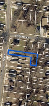
700 Frnt St, Memphis, TN 38107
- Warehouses
- 21,756 SF
- 1.28 lot acres
Property ID
US80-1106484
The Realmo ID is a unique identifier assigned to every property, incorporating country codes and precise geo-coordinates for 300x300-foot land blocks. It enables standardized data collection and seamless integration of disparate sources such as ownership, tax, title data and physical specifications. By aggregating current and historical records, the Realmo ID powers advanced analytics and delivers deep, verifiable insights for real estate professionals.
Location Intelligence
Current Use by Public Records
- Warehouses
Property Details for 700 Frnt St
- Year built
- 1949
- Lot size
- 1.28 lot acres
- Zone code
- MDR
- Property type
- Warehouses
- Property subtype
- Self storage facilities
- APN
- 022-005- - -00009
- APU
- 2200500009
Sales History
| Date | Price | Buyer | Seller | Deed Type | Mortgage |
|---|---|---|---|---|---|
| May 4, 2021 | — | Snuff Historie Warhouses LLC | Wolf River Harbr Holdings LLC | Quit Claim Deed · related | — |
| Nov 21, 2016 | $250,000 | Keel Street LLC | American Snuff Co LLC | Grant Deed | — |
Value Estimations
based on Realmo’s proprietary methodology
-
AI approach
-
CAP approach
-
Comparable approach
-
Alternative Use
Get a detailed, property-specific estimation — fast and free
Location Insight
- Map
- Local Demand
- City
- Memphis
- County
- Shelby
- State
- Tennessee
- Longitude
- -90.0457
- Latitude
- 35.1648
- CBSA code
- 32820
- CBSA name
- MEMPHIS, TN-MS-AR METROPOLITAN STATISTICAL AREA
Property Tax & Assessments
Tax date
Tax Amount
Assessed Land Value
Assessed Improvement Value
Total Assessed Value
Applied Tax Rate
Land Market Value
Improvement Market Value
Total Market Value
2022
$2,220
$22,280
$14,160
$36,440
-
$55,700
$35,400
$91,100