Property Lookup
Property Lookup
  • For Sale
  • For Lease
  • Recently Sold
  • Property Lookup
  • Brokers
Back to Search
Property profile & analytics

70 Powder Mill Rd Maynard, MA 01754

  • Investment properties
  • 2,081 SF
  • 1.06 lot acres
Value Estimation
Location Intelligence
Property ID
US38-1409620
The Realmo ID is a unique identifier assigned to every property, incorporating country codes and precise geo-coordinates for 300x300-foot land blocks. It enables standardized data collection and seamless integration of disparate sources such as ownership, tax, title data and physical specifications. By aggregating current and historical records, the Realmo ID powers advanced analytics and delivers deep, verifiable insights for real estate professionals.

Current Use by Public Records

  • Hawes Florist / Florist

Property Details for 70 Powder Mill Rd

Year built
1900
Construction
FRAME
Lot size
1.06 lot acres
Property size
2,081 SF
Zone code
B
Property type
Investment properties
Property subtype
Live-work space
APN
MAYN M:010.0 P:101.0
APU
MAYNM0100P1010

Description

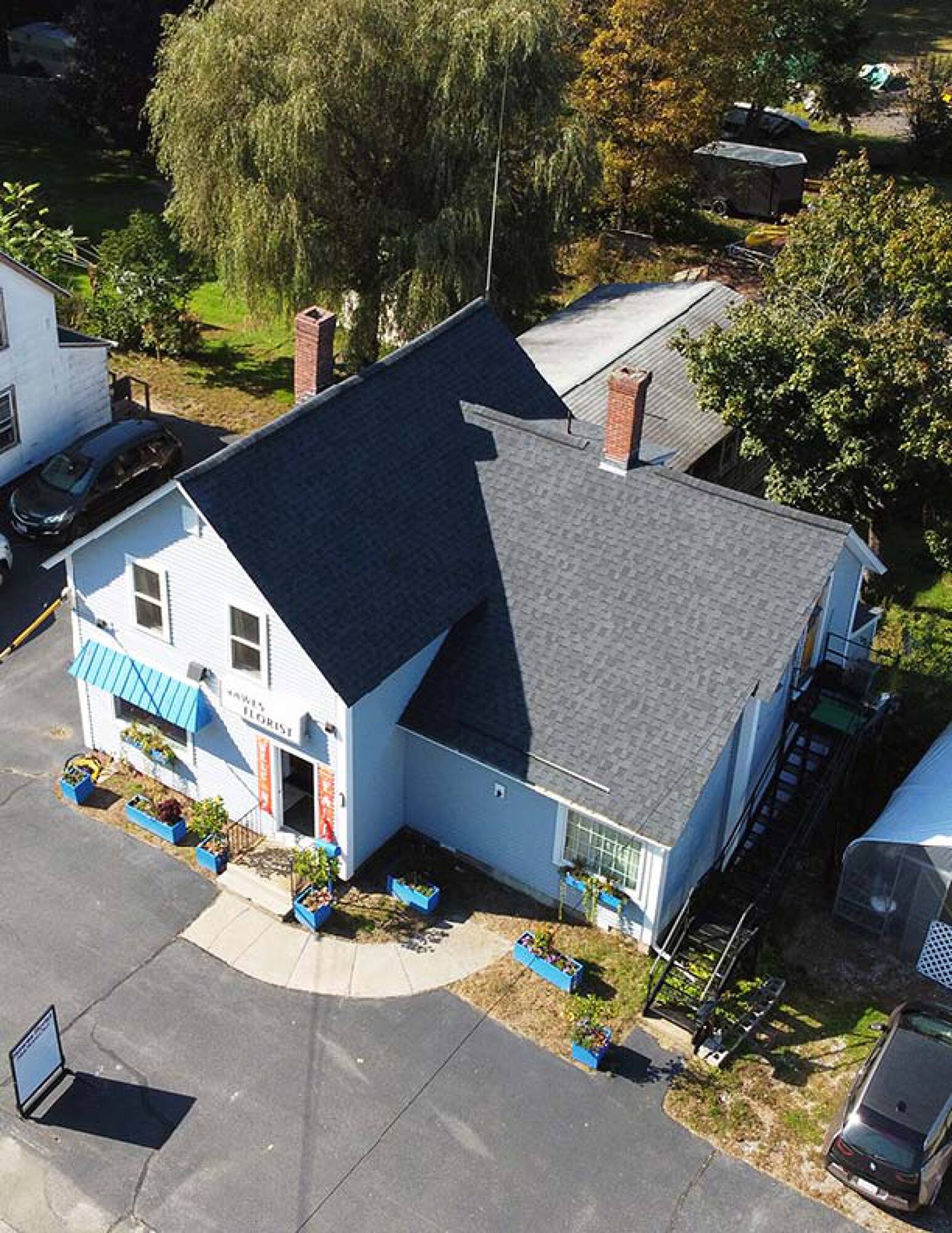
This exceptional development opportunity encompasses three contiguous lots totaling 2.26 acres at 66, 68, and 70 Powder Mill Road in Maynard, Massachusetts. Situated in Middlesex County, zip code 01754, this property presents a rare chance to create a thriving mixed-use development. Currently featuring existing multifamily and retail spaces, the site benefits from its location within Maynard's anticipated overlay district. This zoning designation offers increased flexibility, allowing for a diverse range of projects, including residential, retail, restaurant, office, and personal service uses. Special permits may even allow for hotels and other unique ventures. The properties are ideally positioned along the scenic Assabet River, offering a unique and desirable setting for a new development. This is more than just a development site

Value Estimation

by Realmo proprietary methodology Last update: July 3, 2025
  • AI approach

    CAP return
    Estimation
    Estimation
    $285,000
  • CAP approach

    CAP return
    Estimation
    6%
    $390,000
    6.5%
    $430,000
    7%
    $435,000
  • Comparable approach

    Method
    Estimation
    Relative Method
    $360,000
    Geo Method
    $460,000
  • Alternative Use

    Use
    Estimation
    Distribution
    $405,000
    Retail
    $390,000
    Mixed-Use
    $350,000
    Hospitality
    $440,000
    Educational
    $440,000
    Residential Income
    $395,000
    Energy
    $380,000
    Income-Based Land
    $440,000
    Food Service
    $400,000

Location Insight

  • Map
  • Local Demand
City
Maynard
County
Middlesex
State
Massachusetts
Longitude
-71.4437
Latitude
42.4376
CBSA code
14460
CBSA name
BOSTON-CAMBRIDGE-QUINCY, MA-NH METROPOLITAN STATISTICAL AREA

Property Tax & Assessments

Tax date
Tax Amount
Assessed Land Value
Assessed Improvement Value
Total Assessed Value
Applied Tax Rate
Land Market Value
Improvement Market Value
Total Market Value
2024
$0.00
$315,200
$104,700
$419,900
-
$0.00
$0.00
$0.00
More about this property
Thanks! Your message was sent.
Error! Your message wasn't sent.
Please enter your name
Please enter email
Please enter the email in the correct format
Please enter phone
Please enter the number in the correct format
Please enter message