672 Fm 980th Rd Huntsville, TX 77320-7406
Property profile & analytics
672 Fm 980th Rd, Huntsville, TX 77320-7406
- Specialty properties
- 3,912 SF
- 16.47 lot acres
Property ID
US82-6482364
The Realmo ID is a unique identifier assigned to every property, incorporating country codes and precise geo-coordinates for 300x300-foot land blocks. It enables standardized data collection and seamless integration of disparate sources such as ownership, tax, title data and physical specifications. By aggregating current and historical records, the Realmo ID powers advanced analytics and delivers deep, verifiable insights for real estate professionals.
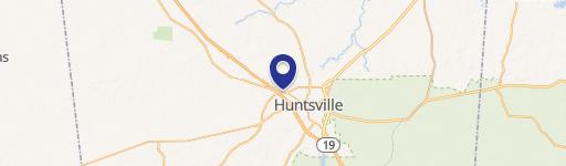
Location Intelligence
Current Use by Public Records
- Brooke Funeral Home Cemetery Crmtry / Social Service Agency
- Waller-Thornton Funeral Home-Huntsville, LLP / Social Service Agency
Property Details for 672 Fm 980th Rd
- Year built
- 1901
- Lot size
- 16.47 lot acres
- Property type
- Specialty properties
- APN
- 13818
- APU
- 13818
Sales History
| Date | Price | Buyer | Seller | Deed Type | Mortgage |
|---|---|---|---|---|---|
| Sep 25, 2024 | — | E & E Funeral Services LLC | Funeral Home-huntsville LLP | Warranty Deed | — |
| Feb 8, 2023 | — | E & E Funeral Services LLC | Waller Thornton Funeral Home Huntsv | Warranty Deed | — |
Value Estimations
based on Realmo’s proprietary methodology
-
AI approach
-
CAP approach
-
Comparable approach
-
Alternative Use
Get a detailed, property-specific estimation — fast and free
Location Insight
- Map
- Local Demand
- City
- Huntsville
- County
- Walker
- State
- Texas
- Longitude
- -95.5345
- Latitude
- 30.7855
- CBSA code
- 26660
- CBSA name
- HUNTSVILLE, TX MICROPOLITAN STATISTICAL AREA
Property Tax & Assessments
Tax date
Tax Amount
Assessed Land Value
Assessed Improvement Value
Total Assessed Value
Applied Tax Rate
Land Market Value
Improvement Market Value
Total Market Value
2023
$5,919
$458,410
$360,780
$819,190
-
$458,410
$360,780
$819,190