67-1185 Mamalahoa Hwy Kamuela, HI 96743-7304
Property profile & analytics
67-1185 Mamalahoa Hwy, Kamuela, HI 96743-7304
- Commercial real estate
- 45,886 SF
- 14.24 lot acres
Property ID
US24-0377984
The Realmo ID is a unique identifier assigned to every property, incorporating country codes and precise geo-coordinates for 300x300-foot land blocks. It enables standardized data collection and seamless integration of disparate sources such as ownership, tax, title data and physical specifications. By aggregating current and historical records, the Realmo ID powers advanced analytics and delivers deep, verifiable insights for real estate professionals.
Location Intelligence
Current Use by Public Records
- Commercial real estate
Property Details for 67-1185 Mamalahoa Hwy
- Year built
- 1965
- Construction
- WOOD
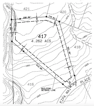
- Lot size
- 14.24 lot acres
- Zone code
- 3L
- Property type
- Commercial real estate
- APN
- 3-6-7-002-030
- APU
- 367002030
Sales History
| Date | Price | Buyer | Seller | Deed Type | Mortgage |
|---|---|---|---|---|---|
| May 19, 2016 | — | Atc Sequoia LLC | Cellco Ptshp | Grant Deed · related | — |
| Sep 12, 2008 | — | Hawaii Tire Co LLC | — | Trustees Deed · related | $1.2M · First Hawaiian Bank |
| Aug 22, 2008 | $1,108,581 | Hawaii Tire Co LLC | Us Reif Mjw Waimea Fee LLC | Grant Deed · related | — |
| Dec 28, 2007 | $45,120,000 | Us Reif Of Mjw Waimea Fee LLC | Waimea Retail LLC | Grant Deed · related | — |
| Dec 22, 2005 | $31,150,000 | Waimea Retail LLC | Parker Ranch Center LLC | Grant Deed · related | $20M · Column Financial INC |
| Dec 19, 2005 | — | Record Owner | Owner,record | Quit Claim Deed · related | — |
| Dec 15, 2005 | — | Record Owner | Owner,record | Quit Claim Deed · related | — |
| Dec 27, 2004 | $298,515 | Foundation Health Plan Kaiser | Parker Ranch Center LLC | Grant Deed · related | — |
| Sep 21, 2000 | — | Parker Ranch Center LLC | Smark Trust | Trustees Deed · related | — |
Value Estimations
based on Realmo’s proprietary methodology
-
Comparable approach
- Method
- Estimation
- AI Estimate
- $5,652,000
Market price range: $1.50M - $5.65M -
Alternative Use
- Use
- Estimation
- COMMERCIAL (GENERAL)
- $10,150,000 Current use
Get a detailed, property-specific estimation — fast and free
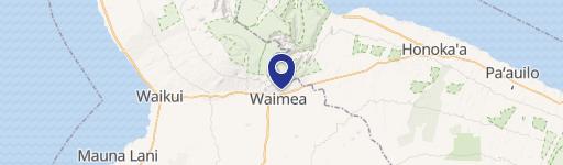
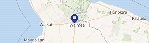
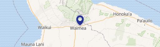
Location Insight
- Map
- Local Demand
- City
- Kamuela
- County
- Hawaii
- State
- Hawaii
- Longitude
- -155.667
- Latitude
- 20.0204
- CBSA code
- 25900
- CBSA name
- HILO, HI MICROPOLITAN STATISTICAL AREA
Property Tax & Assessments
Tax date
Tax Amount
Assessed Land Value
Assessed Improvement Value
Total Assessed Value
Applied Tax Rate
Land Market Value
Improvement Market Value
Total Market Value
2023
$376,475
$18,376,600
$18,168,400
$36,545,000
-
$18,376,600
$18,168,400
$36,545,000