6657 Woodland Dr Shawnee, KS 66218-9745
Property profile & analytics
6657 Woodland Dr, Shawnee, KS 66218-9745
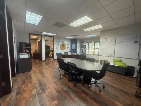
- Office Spaces
- 4,164 SF
- 1.08 lot acres
Property ID
US33-0212660
The Realmo ID is a unique identifier assigned to every property, incorporating country codes and precise geo-coordinates for 300x300-foot land blocks. It enables standardized data collection and seamless integration of disparate sources such as ownership, tax, title data and physical specifications. By aggregating current and historical records, the Realmo ID powers advanced analytics and delivers deep, verifiable insights for real estate professionals.
Location Intelligence
Current Use by Public Records
- Office Spaces
Property Details for 6657 Woodland Dr
- Year built
- 1919
- Construction
- FRAME
- Lot size
- 1.08 lot acres
- Zone code
- CH
- Property type
- Office Spaces
- APN
- QF231214-3002
- APU
- QF2312143002
Sales History
| Date | Price | Buyer | Seller | Deed Type | Mortgage |
|---|---|---|---|---|---|
| Feb 9, 2022 | — | Huenos Dias Real Estate LLC | — | Deed · related | $225k · Us Bank NA |
| May 13, 2021 | — | Hamele Family Nvestments LLC | — | Deed · related | $250k · Nbkc Bank |
| Oct 27, 2017 | — | Hamele Family Investments LLC | — | Deed · related | $224k · National Bank Of Kansas City |
Value Estimations
based on Realmo’s proprietary methodology
-
AI approach
-
CAP approach
-
Comparable approach
-
Alternative Use
Get a detailed, property-specific estimation — fast and free
Location Insight
- Map
- Local Demand
- City
- Shawnee
- County
- Johnson
- State
- Kansas
- Longitude
- -94.8249
- Latitude
- 39.0079
- CBSA code
- 28140
- CBSA name
- KANSAS CITY, MO-KS METROPOLITAN STATISTICAL AREA
Property Tax & Assessments
Tax date
Tax Amount
Assessed Land Value
Assessed Improvement Value
Total Assessed Value
Applied Tax Rate
Land Market Value
Improvement Market Value
Total Market Value
2023
$10,746
$35,148
$51,103
$86,251
-
$140,590
$204,410
$345,000