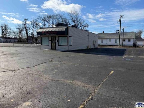
6515 State Rd 42 Terre Haute, IN 47803-9220
Property profile & analytics
6515 State Rd 42, Terre Haute, IN 47803-9220
- Warehouses
- 7,250 SF
- 3.39 lot acres
Property ID
US31-0347198
The Realmo ID is a unique identifier assigned to every property, incorporating country codes and precise geo-coordinates for 300x300-foot land blocks. It enables standardized data collection and seamless integration of disparate sources such as ownership, tax, title data and physical specifications. By aggregating current and historical records, the Realmo ID powers advanced analytics and delivers deep, verifiable insights for real estate professionals.
Location Intelligence
Current Use by Public Records
- Warehouses
Property Details for 6515 State Rd 42
- Year built
- 1975
- Construction
- WOOD
- Lot size
- 3.39 lot acres
- Property type
- Warehouses
- APN
- 84-07-29-200-013.000-009
- APU
- 840729200013000009
Sales History
| Date | Price | Buyer | Seller | Deed Type | Mortgage |
|---|---|---|---|---|---|
| Jan 27, 2025 | — | Dsm Commercial LLC | Mundell Properties LLC | Quitclaim Deed · related | — |
| Sep 29, 2023 | — | Mundell Properties LLC | Max E Helton JR | Warranty Deed | $482k · The Riddell National Bank |
| Aug 18, 2009 | $5,650 | State Of Indiana | Max E Helton JR | Warranty Deed | — |
Value Estimations
based on Realmo’s proprietary methodology
-
AI approach
-
CAP approach
-
Comparable approach
-
Alternative Use
Get a detailed, property-specific estimation — fast and free
Location Insight
- Map
- Local Demand
- City
- Terre Haute
- County
- Vigo
- State
- Indiana
- Longitude
- -87.3171
- Latitude
- 39.4619
- CBSA code
- 45460
- CBSA name
- TERRE HAUTE, IN METROPOLITAN STATISTICAL AREA
Property Tax & Assessments
Tax date
Tax Amount
Assessed Land Value
Assessed Improvement Value
Total Assessed Value
Applied Tax Rate
Land Market Value
Improvement Market Value
Total Market Value
2023
$3,244
$27,200
$75,400
$102,600
-
$27,200
$75,400
$102,600