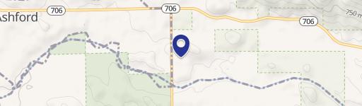
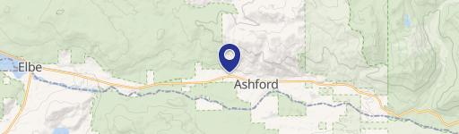
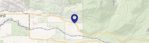
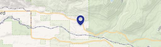
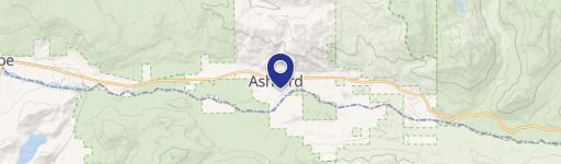
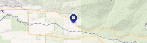
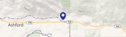
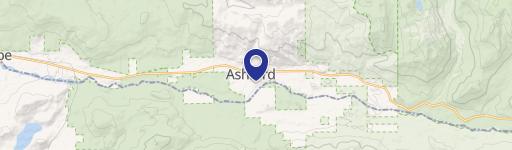
550 Airport E Rd Ashford, WA 98304
Property profile & analytics
550 Airport E Rd, Ashford, WA 98304
- Industrial land
- 3,342 SF
- 6.06 lot acres
Property ID
US90-2576319
The Realmo ID is a unique identifier assigned to every property, incorporating country codes and precise geo-coordinates for 300x300-foot land blocks. It enables standardized data collection and seamless integration of disparate sources such as ownership, tax, title data and physical specifications. By aggregating current and historical records, the Realmo ID powers advanced analytics and delivers deep, verifiable insights for real estate professionals.
Location Intelligence
Current Use by Public Records
- Industrial land
Property Details for 550 Airport E Rd
- Year built
- 1958
- Construction
- WOOD FRAME
- Lot size
- 6.06 lot acres
- Zone code
- AP
- Property type
- Industrial land
- APN
- 416141043
- APU
- 416141043
Sales History
| Date | Price | Buyer | Seller | Deed Type | Mortgage |
|---|---|---|---|---|---|
| Aug 23, 2017 | — | Landings At Mt Rainier LLC | Burlingame,sharon J | Quit Claim Deed · related | — |
| Sep 2, 2004 | — | Harold W Burlingame | Burlingame,rosalie | Quit Claim Deed · related | — |
Value Estimations
based on Realmo’s proprietary methodology
-
AI approach
- Method
- Estimation
- ML approach
- $315,000
-
CAP approach
- CAP Return
- Estimation
- 6%
- $560,000
- 6.5%
- $515,000
- 7%
- $480,000
-
Comparable approach
- Method
- Estimation
- AI Estimate
- $323,000
Market price range: $140k - $918k
Get a detailed, property-specific estimation — fast and free
Location Insight
- Map
- Local Demand
- City
- Ashford
- County
- Pierce
- State
- Washington
- Longitude
- -122.257
- Latitude
- 46.8728
- CBSA code
- 42660
- CBSA name
- SEATTLE-TACOMA-BELLEVUE, WA METROPOLITAN STATISTICAL AREA
Property Tax & Assessments
Tax date
Tax Amount
Assessed Land Value
Assessed Improvement Value
Total Assessed Value
Applied Tax Rate
Land Market Value
Improvement Market Value
Total Market Value
2024
$3
$489,600
$0.00
$489,600
-
$489,600
$0.00
$489,600