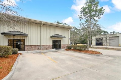
5280 Hwy 22 Mandeville, LA 70471-2522
Property profile & analytics
5280 Hwy 22, Mandeville, LA 70471-2522
- Commercial real estate
- 3,616 SF
- 1.00 lot acres
Property ID
US36-1493260
The Realmo ID is a unique identifier assigned to every property, incorporating country codes and precise geo-coordinates for 300x300-foot land blocks. It enables standardized data collection and seamless integration of disparate sources such as ownership, tax, title data and physical specifications. By aggregating current and historical records, the Realmo ID powers advanced analytics and delivers deep, verifiable insights for real estate professionals.
Location Intelligence
Current Use by Public Records
- Commercial real estate
Property Details for 5280 Hwy 22
- Year built
- 2008
- Lot size
- 1.00 lot acres
- Property type
- Commercial real estate
- APN
- 45915
- APU
- 45915
Sales History
| Date | Price | Buyer | Seller | Deed Type | Mortgage |
|---|---|---|---|---|---|
| Feb 3, 2025 | $1,300,000 | Riverfront Village LLC | Penelope T Rodas | Deed | $1.3M · Metairie Bank & Trust |
| Aug 30, 2017 | $430,000 | Osman Rodas | Albert J Devoe JR | Deed | $784k · Gulf Coast Bank & Trust Co |
| May 1, 2009 | $439,000 | Tin Tin Swe Devoe | Rose Marie Vinterella Giordano | Cash Sale Deed | $330k · Resource Bank |
Value Estimations
based on Realmo’s proprietary methodology
-
AI approach
- Method
- Estimation
- Statistic approach
- $1,105,000
- ML approach
- $1,170,000
Get a detailed, property-specific estimation — fast and free
Location Insight
- Map
- Local Demand
- City
- Mandeville
- County
- Saint Tammany
- State
- Louisiana
- Longitude
- -90.1245
- Latitude
- 30.4052
- CBSA code
- 35380
- CBSA name
- NEW ORLEANS-METAIRIE-KENNER, LA METROPOLITAN STATISTICAL AREA
Property Tax & Assessments
Tax date
Tax Amount
Assessed Land Value
Assessed Improvement Value
Total Assessed Value
Applied Tax Rate
Land Market Value
Improvement Market Value
Total Market Value
2023
$8,813
$25,704
$40,788
$66,492
-
$257,040
$271,920
$528,960