Property profile & analytics
502 Millbrook Ave Randolph, NJ 07869-3702
- Commercial real estate
- 38,398 SF
- 18.10 lot acres
OFF-MARKET
Value Estimations
$4,365,000
Show details
Cap Rate Potential
Location Intelligence
Property ID
US59-1454448
The Realmo ID is a unique identifier assigned to every property, incorporating country codes and precise geo-coordinates for 300x300-foot land blocks. It enables standardized data collection and seamless integration of disparate sources such as ownership, tax, title data and physical specifications. By aggregating current and historical records, the Realmo ID powers advanced analytics and delivers deep, verifiable insights for real estate professionals.
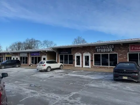
Current Use by Public Records
- Randolph Twp Engineering / City Government Office
- Randolph Township Health Department / Public Health Department
- Artworks Studio / High School
- RandolphTownHall / City Hall
- Randolph Twp Planning Office / City Government Office
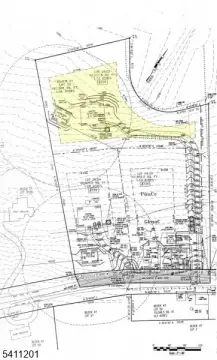
Property Details for 502 Millbrook Ave
- Lot size
- 18.10 lot acres
- Property size
- 38,398 SF
- Zone code
- RR
- Property type
- Commercial real estate
- APN
- 32 00119-0000-00119-0000-X
- APU
- 32001190000001190000X
Value Estimations
based on Realmo’s proprietary methodology
-
CAP approach
- CAP Return
- Estimation
- 6%
- $4,700,000
- 6.5%
- $4,335,000
- 7%
- $4,025,000
-
Comparable approach
- Method
- Estimation
- Statistic Estimate
- $5,972,000
- AI Estimate
- $2,785,000
Market price range: $5.97M - $8.71MMarket price range: $2.79M - $8.27M -
Alternative Use
- Use
- Estimation
- COMMERCIAL (GENERAL)
- $6,885,000 Current use
- INDUSTRIAL (GENERAL)
- $6,865,000 Change: -0% Conversion: Moderate
Get a detailed, property-specific valuation — fast and free
Location Insight
- Map
- Local Demand
- City
- Randolph
- County
- Morris
- State
- New Jersey
- Longitude
- -74.5627
- Latitude
- 40.8464
- CBSA code
- 35620
- CBSA name
- NEW YORK-NORTHERN NEW JERSEY-LONG ISLAND, NY-NJ-PA METROPOLITAN STATISTICAL AREA
Property Tax & Assessments
Tax date
Tax Amount
Assessed Land Value
Assessed Improvement Value
Total Assessed Value
Applied Tax Rate
Land Market Value
Improvement Market Value
Total Market Value
2023
$16,742
$442,200
$164,400
$606,600
-
$442,200
$164,400
$606,600