4771 Date Ave Fresno, CA 93725-2102
Property profile & analytics
4771 Date Ave, Fresno, CA 93725-2102
- Industrial land
- 1.77 lot acres
Property ID
US09-3403288
The Realmo ID is a unique identifier assigned to every property, incorporating country codes and precise geo-coordinates for 300x300-foot land blocks. It enables standardized data collection and seamless integration of disparate sources such as ownership, tax, title data and physical specifications. By aggregating current and historical records, the Realmo ID powers advanced analytics and delivers deep, verifiable insights for real estate professionals.
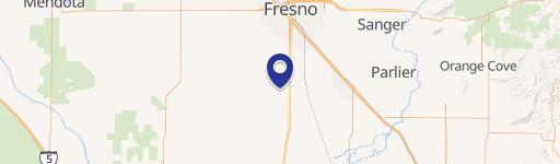
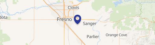
Location Intelligence
Current Use by Public Records
- Industrial land
Property Details for 4771 Date Ave
- Lot size
- 1.77 lot acres
- Zone code
- M3
- Property type
- Industrial land
- APN
- 487-091-26
- APU
- 48709126
Sales History
| Date | Price | Buyer | Seller | Deed Type | Mortgage |
|---|---|---|---|---|---|
| Sep 3, 2025 | — | 4791 Date Avenue LLC | Anne Roberts Kempees Trust | Deed · related | — |
| Jan 18, 2008 | — | Kempees Anne R Trust | Roberts Edward & M Trust | Grant Deed · related | — |
| Apr 12, 1983 | — | Charles R Etal Breyer | Owner Name Unavailable | Grant Deed · related | — |
Value Estimations
based on Realmo’s proprietary methodology
-
AI approach
-
CAP approach
-
Comparable approach
-
Alternative Use
Get a detailed, property-specific estimation — fast and free
Location Insight
- Map
- Local Demand
- City
- Fresno
- County
- Fresno
- State
- California
- Longitude
- -119.738
- Latitude
- 36.702
- CBSA code
- 23420
- CBSA name
- FRESNO, CA METROPOLITAN STATISTICAL AREA
Property Tax & Assessments
Tax date
Tax Amount
Assessed Land Value
Assessed Improvement Value
Total Assessed Value
Applied Tax Rate
Land Market Value
Improvement Market Value
Total Market Value
2024
$1,473
$99,279
$8,091
$107,370
-
$0.00
$0.00
$0.00