455 Ave H Ave Boise, ID 83712-6449
R-2 Residential: Compact Neighborhood Overlay Districts R-3 Residential: Urban BC-O Big Sky Overlay MIXED-USE DISTRICTS SC-O Sycamore Overlay MX-1 Mixed-Use: Neighborhood Design Review Overlay Districts MX-2 Mixed-Use: General CD-O Capitol Boulevard Design Overlay MX-3 Mixed-Use: Active HD-O Historic Design Overlay MX-4 Mixed-Use: Transit Oriented Developmen…
Cap rate
Implied · in-place · derived from last sale + estimated NOIValue
AI, CAP & Alternative Use estimations · Realmo proprietary blendProperty tax & assessments
Tax year 2022Comparables
6 recent transactions · within 1.5 miComparable in this City


Similar Nearby for Sale
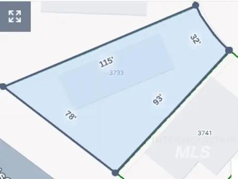
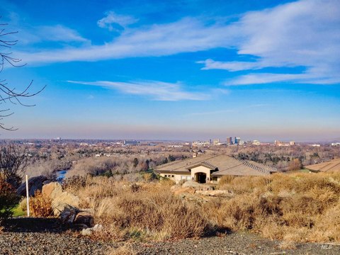
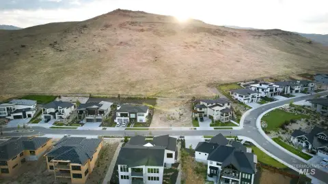
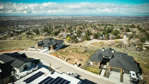
Property description
Physical attributes from public recordsZoning & alternative use
R-2 · Boise, IDR-2 Residential: Compact Neighborhood Overlay Districts R-3 Residential: Urban BC-O Big Sky Overlay MIXED-USE DISTRICTS SC-O Sycamore Overlay MX-1 Mixed-Use: Neighborhood Design Review Overlay Districts MX-2 Mixed-Use: General CD-O Capitol Boulevard Design Overlay MX-3 Mixed-Use: Active HD-O Historic Design Overlay MX-4 Mixed-Use: Transit Oriented Development (TOD) Node Sensitive Lands Overlay Districts MX-5 Mixed-Use: Downtown AI-O Airport Influence Area Overlay MX-U Mixed-Use: University BR-O Boise River System Overlay MX-H Mixed-Use: Health FP-O Flood Protection Overlay INDUSTRIAL DISTRICTS HS-O Hillside Development Overlay I-1 Industrial: Light WUI-O Wildland Urban Interface Overlay I-2 Industrial: Heavy SPECIFIC PLAN DISTRICTS I-3 Industrial: Technology SP-1 Harris Ranch Specific Plan District OPEN LAND DISTRICTS SP-2 Barber Valley Specific Plan District A-1 Open Land: Very Low Density SP-3 Syringa Valley Specific Plan District A-2 Open Land: Reserve 2. Official Zoning Map: A. Incorporation of Map: (1) The location and boundaries of zoning districts are shown upon the Official Zoning Map for Boise City. (2) The Official Zoning Map shall be maintained by, and copies will be obtained through the Planning and Development Services Department and shall be made available for review and inspection. A digital version of the Official Zoning Map will be made available through the City's website. B. Rules for Interpretation of Boundaries: Wherever any uncertainty exists as to the boundary of a district, the following rules shall apply: (1) Where any boundary line is indicated as following a street, alley, waterway, railroad right-of-way or public way, it shall be construed as following the centerline thereof. (2) Where a boundary line is indicated as approximately following a lot line/property line, such lot line/property line shall be construed to be the boundary line. (3) A parcel with two or more zoning districts or overlays shall meet the applicable development parameters such as uses, density, coverage, height, setbacks, and applicable regulations for each particular zone separately for each portion of the parcel which is split-zoned. C. Amendments to the Official Zoning Map: Changes to the boundaries of any zoning district require an amendment to the Official Zoning Map per Section 11-05-05 .4.I, Zoning Map Amendment (Rezoning, including Planned Unit Development). 3. Organization Of This Chapter: A. Base Zoning Districts: (1) Content: Sections 11-02-02 through 11-02-06 follow a common structure for each base zoning district in Boise.
Costs & Benchmarks
Operating expenses, capex projections, utility benchmarks, and submarket comparables — all in one view.
Risks
Flood, climate, environmental, title, and tenant-concentration risk — surfaced with mitigations and source citations.


