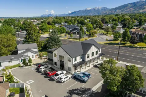
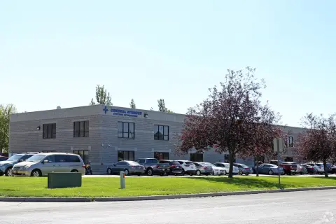
450 Flint St Kaysville, UT 84037-9777
Property profile & analytics
450 Flint St, Kaysville, UT 84037-9777
- Industrial properties
- 16,432 SF
- 1.59 lot acres
Property ID
US86-0527724
The Realmo ID is a unique identifier assigned to every property, incorporating country codes and precise geo-coordinates for 300x300-foot land blocks. It enables standardized data collection and seamless integration of disparate sources such as ownership, tax, title data and physical specifications. By aggregating current and historical records, the Realmo ID powers advanced analytics and delivers deep, verifiable insights for real estate professionals.
Location Intelligence
Current Use by Public Records
- Industrial properties
Property Details for 450 Flint St
- Year built
- 1986
- Lot size
- 1.59 lot acres
- Zone code
- LI
- Property type
- Industrial properties
- APN
- 11-657-0003
- APU
- 116570003
Sales History
| Date | Price | Buyer | Seller | Deed Type | Mortgage |
|---|---|---|---|---|---|
| Sep 28, 2022 | — | Lot Lands LLC | Kenneth A Sheffield | Warranty Deed | — |
| Aug 1, 2022 | — | Kenneth Sheffield | Kenneth Sheffield | Intrafamily Transfer · related | $633k · Jpmorgan Chase Bank NA |
Value Estimations
based on Realmo’s proprietary methodology
-
AI approach
- Method
- Estimation
- ML approach
- $565,000
-
Comparable approach
- Method
- Estimation
- AI Estimate
- $737,000
Market price range: $490k - $1.25M -
Alternative Use
- Use
- Estimation
- INDUSTRIAL (GENERAL)
- $925,000 Current use
Get a detailed, property-specific estimation — fast and free
Location Insight
- Map
- Local Demand
- City
- Kaysville
- County
- Davis
- State
- Utah
- Longitude
- -111.965
- Latitude
- 41.0423
- CBSA code
- 36260
- CBSA name
- OGDEN-CLEARFIELD, UT METROPOLITAN STATISTICAL AREA
Property Tax & Assessments
Tax date
Tax Amount
Assessed Land Value
Assessed Improvement Value
Total Assessed Value
Applied Tax Rate
Land Market Value
Improvement Market Value
Total Market Value
2024
$12,362
$269,214
$447,740
$716,954
-
$489,481
$814,074
$1,303,555