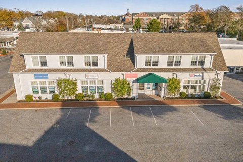
42 Sandy Holw Rd Southampton, NY 11968-5407
R20 Residential 20,000 CR40 County Residential 40,000 B. Riverside Overlay District Boundary Map. § 330-406 (Reserved) § 330-407 ROD Zoning Standards Map. A. The ROD is divided into the following Overlay Districts, shown as RO-1, RO-2, RO-3, RO-4, RO-5, RO-6, and RO-7. The boundaries of these Overlay Zones are shown on the Zoning Standards Map and the Town o…
Cap rate
Implied · in-place · derived from last sale + estimated NOIValue
AI, CAP & Alternative Use estimations · Realmo proprietary blendProperty tax & assessments
Tax year 2020Comparables
6 recent transactions · within 1.5 miComparable in this City


Similar Nearby for Sale


Similar Nearby for Lease


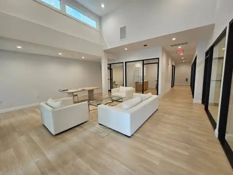


Property description
Physical attributes from public recordsZoning & alternative use
R20 · Southampton, NYR20 Residential 20,000 CR40 County Residential 40,000 B. Riverside Overlay District Boundary Map. § 330-406 (Reserved) § 330-407 ROD Zoning Standards Map. A. The ROD is divided into the following Overlay Districts, shown as RO-1, RO-2, RO-3, RO-4, RO-5, RO-6, and RO-7. The boundaries of these Overlay Zones are shown on the Zoning Standards Map and the Town of Southampton Zoning Map. B. The Riverside Overlay District consists of the following districts: (1) RO-1 Riverside Hamlet Center. The intent of this district, located within 1/4 mile of Downtown Riverhead and the Riverside traffic circle, is to encourage public activities and the greatest variety and mix of uses, including a range of residential, retail, hospitality, cultural and entertainment uses. The RO-1 District permits the highest densities and requires compact design with vertically and horizontally integrated residential and nonresidential uses. Parking standards and pedestrian amenities required in this zone reflect its pedestrian access to waterfront and existing walkable downtown with commuter rail, and other transit options. (2) RO-2 Riverside Hamlet Neighborhood. The intent of this district, located within 1/2 mile of Downtown Riverhead and the Riverside traffic circle, is to support, similarly to the RO-1 District, a wide variety and mix of uses, promoting a range of retail choices and commercial uses as well as a variety of residential options. The RO-2 District also permits the highest densities and promotes compact design with vertically and horizontally integrated residential and nonresidential uses. Parking standards and pedestrian amenities required in this district also reflect its immediate access to Hamlet Center and Downtown Riverhead with commuter rail and other transit options. (3)
No recorded transactions found for this property.
Costs & Benchmarks
Operating expenses, capex projections, utility benchmarks, and submarket comparables — all in one view.
Risks
Flood, climate, environmental, title, and tenant-concentration risk — surfaced with mitigations and source citations.


