40233 State Rte 681 Shade, OH 45776-9561
Property profile & analytics
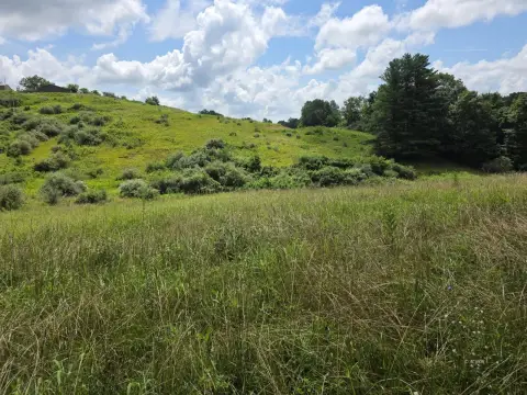
40233 State Rte 681, Shade, OH 45776-9561
- Commercial real estate
- 22.99 lot acres
Property ID
US66-4835253
The Realmo ID is a unique identifier assigned to every property, incorporating country codes and precise geo-coordinates for 300x300-foot land blocks. It enables standardized data collection and seamless integration of disparate sources such as ownership, tax, title data and physical specifications. By aggregating current and historical records, the Realmo ID powers advanced analytics and delivers deep, verifiable insights for real estate professionals.
Location Intelligence
Current Use by Public Records
- Commercial real estate
Property Details for 40233 State Rte 681
- Lot size
- 22.99 lot acres
- Property type
- Commercial real estate
- APN
- 100845000
- APU
- 100845000
Sales History
| Date | Price | Buyer | Seller | Deed Type | Mortgage |
|---|---|---|---|---|---|
| Aug 7, 2023 | $157,000 | River City Real Property LLC | Farmers Bank And Savings Company | Limited Warranty Deed | — |
| Jul 7, 2023 | $130,000 | Farmers Bank And Savings Company | Brent M Whaley | Sheriffs Deed · related | — |
| Jun 2, 2016 | — | Brent M Whaley | — | Deed · related | $218k · The Farmers Bank And Savings Co |
| Jul 20, 2012 | — | Brent M Whaley | Herbert E Whaley | Warranty Deed · related | — |
| May 18, 2005 | — | Brent M Whaley | Herbert E Whaley | Warranty Deed · related | — |
Value Estimations
based on Realmo’s proprietary methodology
-
AI approach
-
CAP approach
-
Comparable approach
-
Alternative Use
Get a detailed, property-specific estimation — fast and free
Location Insight
- Map
- Local Demand
- City
- Shade
- County
- Meigs
- State
- Ohio
- Longitude
- -82.0405
- Latitude
- 39.1573
Property Tax & Assessments
Tax date
Tax Amount
Assessed Land Value
Assessed Improvement Value
Total Assessed Value
Applied Tax Rate
Land Market Value
Improvement Market Value
Total Market Value
2023
$1,154
$7,250
$22,850
$30,100
-
$20,710
$65,280
$85,990