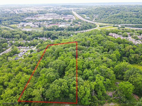
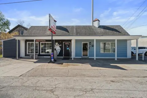
3902 Lonsdale St Cincinnati, OH 45227-3526
Property profile & analytics
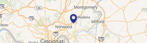
3902 Lonsdale St, Cincinnati, OH 45227-3526
- Warehouses
- 1,800 SF
- 0.11 lot acres
Property ID
US66-6063720
The Realmo ID is a unique identifier assigned to every property, incorporating country codes and precise geo-coordinates for 300x300-foot land blocks. It enables standardized data collection and seamless integration of disparate sources such as ownership, tax, title data and physical specifications. By aggregating current and historical records, the Realmo ID powers advanced analytics and delivers deep, verifiable insights for real estate professionals.
Location Intelligence
Current Use by Public Records
- Forsee Plumbing / Plumbing Service / General Contractor
Property Details for 3902 Lonsdale St
- Year built
- 1950
- Lot size
- 0.11 lot acres
- Property type
- Warehouses
- Property subtype
- Self storage facilities
- APN
- 523-0006-0127-00
- APU
- 5230006012700
Sales History
| Date | Price | Buyer | Seller | Deed Type | Mortgage |
|---|---|---|---|---|---|
| Mar 18, 2004 | $85,000 | Robert G Forsee JR. | Harlyn 2 LLC | Grant Deed | $68k · Guardian Savings Bank Fsb |
| Dec 12, 2002 | — | Harlyn 2 LLC | Harrys Osgood Family LP | Grant Deed · related | — |
| Dec 8, 1998 | $71,000 | Harry S Osgood Family Ptshp | Moore,cecil & Mary L | Grant Deed | $53k · Star Bank |
Value Estimations
based on Realmo’s proprietary methodology
-
AI approach
-
CAP approach
-
Comparable approach
-
Alternative Use
Get a detailed, property-specific estimation — fast and free
Location Insight
- Map
- Local Demand
- City
- Cincinnati
- County
- Hamilton
- State
- Ohio
- Longitude
- -84.3921
- Latitude
- 39.1458
- CBSA code
- 17140
- CBSA name
- CINCINNATI-MIDDLETOWN, OH-KY-IN METROPOLITAN STATISTICAL AREA
Property Tax & Assessments
Tax date
Tax Amount
Assessed Land Value
Assessed Improvement Value
Total Assessed Value
Applied Tax Rate
Land Market Value
Improvement Market Value
Total Market Value
2023
$3,260
$12,128
$20,804
$32,932
-
$34,650
$59,440
$94,090