
372 Marion Rd, Wareham, MA 02571
 For Sale
1 / 4
For Sale
1 / 4
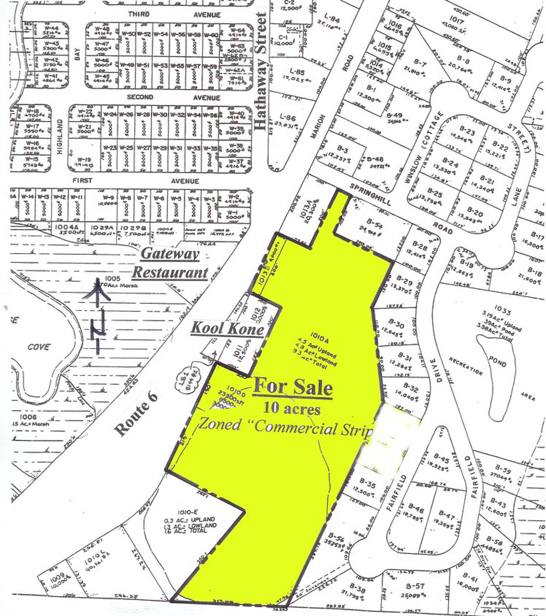
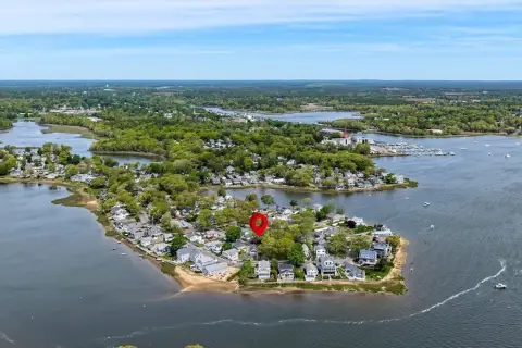
This exceptional 9.29-acre parcel of commercially zoned land presents a remarkable opportunity for development in the thriving town of Wareham, Massachusetts. Strategically located on Route 6, this property boasts exceptional visibility and accessibility, ensuring high traffic exposure for any commercial venture. Approximately 4 acres are usable and ideally suited for a variety of commercial uses, including retail establishments and office spaces. The property's location in Plymouth County, with its address at 372 Marion Road, Wareham, MA 02571, offers convenient access to major transportation routes and a strong local market. The expansive acreage provides ample space for substantial development, allowing for flexibility in design and construction to meet specific business needs. This prime location, combined with the significant land area, makes this property an attractive investment for developers and businesses seeking a high-impact presence in a growing community. The property's latitude and longitude coordinates are 41.74258276100136 and -70.74130223596495 respectively. This is a rare opportunity to acquire a large, commercially zoned parcel in a desirable location. Serious inquiries are encouraged.
Cap rate
Implied · in-place · derived from last sale + estimated NOIValue
AI, CAP & Alternative Use estimations · Realmo proprietary blendProperty tax & assessments
Tax year 2024Comparables
6 recent transactions · within 1.5 miComparable in this City


Similar Nearby for Sale


Similar Nearby for Lease


Property description
Physical attributes from public recordsZoning & alternative use
No recorded transactions found for this property.
Costs & Benchmarks
Operating expenses, capex projections, utility benchmarks, and submarket comparables — all in one view.
Risks
Flood, climate, environmental, title, and tenant-concentration risk — surfaced with mitigations and source citations.


