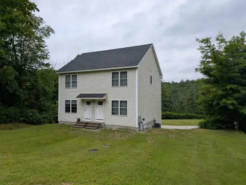
361 Frst Rd Wilton, NH 03086-5136
-
Amherst Tool Industrial Manufacturer
i. When a business outgrows the standards established for a home occupation, it must relocate into a commercial or industrial district. 5.3.1.1 Special Exception Not Required (Adopted March 1998) A home occupation may be conducted without a special exception from the Zoning Board of Adjustment and without site plan review by the Planning Board provided that,…
Cap rate
Implied · in-place · derived from last sale + estimated NOIValue
AI, CAP & Alternative Use estimations · Realmo proprietary blendProperty tax & assessments
Tax year 2023Comparables
6 recent transactions · within 1.5 miComparable in this City


Similar Nearby for Sale


Property description
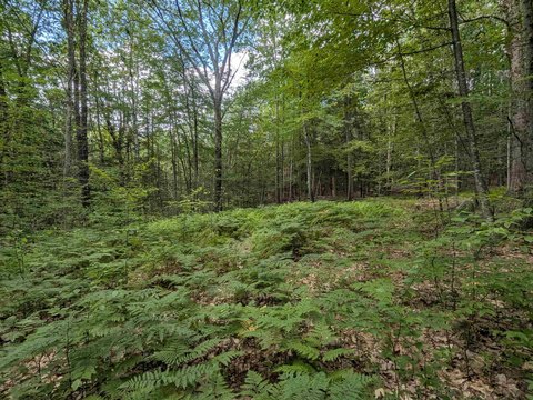
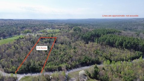
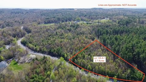
Physical attributes from public recordsZoning & alternative use
I · Wilton, NHi. When a business outgrows the standards established for a home occupation, it must relocate into a commercial or industrial district. 5.3.1.1 Special Exception Not Required (Adopted March 1998) A home occupation may be conducted without a special exception from the Zoning Board of Adjustment and without site plan review by the Planning Board provided that, in addition to the requirements of the preceding section (5.3.1), it also satisfies the following standards: a. The home occupation shall occupy no more than 20% of the existing, gross heated floor area of the primary residence or the structure in which the home occupation is operated. b. There shall be no customer or client visits to the premises and commercial traffic for the delivery or pick-up of materials associated with the home occupation shall be limited to five visits per week. (excluding regular US Postal Service residential service). c. The home occupation shall not employ any non-resident full time or part time employees on the premises. d. No signs are allowed to advertise a home occupation. e. There shall be no outside operation(s) related to the home occupation. 5.3.2 Bed and Breakfasts. Up to four lodging units may be created and rented in an existing dwelling, and meals may be provided to the persons renting the lodging units. The requirements for a bed and breakfast are the same as those for a home occupation, except that requirement 5.3.1 a., shall not apply. 5.3.3 Houses of Worship. Houses of worship including, but not limited to, churches, synagogues, parish houses, mosques, convents and other accessory uses subject to the following conditions (Amended March 2018): a. Minimum frontage of 200 feet on a Class V or better road; b. No off-street parking shall be located within the setbacks nor within the front yard; 5.3.4 Hospitals, emergency medical centers and clinics. Hospitals, emergency medical centers and clinics subject to the following conditions: a. Minimum frontage of 200 feet on a Class I, II or IV road; b. Primary ingress or egress shall be adequate for the use proposed without having a detrimental impact on the neighborhood. 5.3.5 Civic and municipal buildings. 5.3.6 Schools and day care centers. a. All public or non-public schools, kindergarten and grades 1 through 12, that come under the rules adopted by the state board of education and administered by the State Department of Education must receive a special exception from the Zoning Board of Adjustment under
Costs & Benchmarks
Operating expenses, capex projections, utility benchmarks, and submarket comparables — all in one view.
Risks
Flood, climate, environmental, title, and tenant-concentration risk — surfaced with mitigations and source citations.


