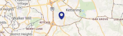
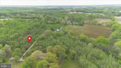
3500 Brown Sta Rd Upper Marlboro, MD 20774-9343
Property profile & analytics
3500 Brown Sta Rd, Upper Marlboro, MD 20774-9343
- Office buildings
- 1,554 SF
- 99.00 lot acres
Property ID
US40-1128043
The Realmo ID is a unique identifier assigned to every property, incorporating country codes and precise geo-coordinates for 300x300-foot land blocks. It enables standardized data collection and seamless integration of disparate sources such as ownership, tax, title data and physical specifications. By aggregating current and historical records, the Realmo ID powers advanced analytics and delivers deep, verifiable insights for real estate professionals.
Location Intelligence
Current Use by Public Records
- SemaConnect Charging Station / Electric Vehicle Charging Station
- Prince George's County Resource Recovery Division / Waste Management Facility / Hazardous Waste Disposal
- Blink Charging Station / Electric Vehicle Charging Station
- SCS Engineers / Civil Engineer / Engineer
- Waste Management Inc / General Contractor / Waste Management Facility
Property Details for 3500 Brown Sta Rd
- Year built
- 1984
- Construction
- BRICK
- Lot size
- 99.00 lot acres
- Zone code
- AG
- Property type
- Office buildings
- APN
- 03-0230078
- APU
- 30230078
Value Estimations
based on Realmo’s proprietary methodology
-
AI approach
-
CAP approach
-
Comparable approach
-
Alternative Use
Get a detailed, property-specific estimation — fast and free
Location Insight
- Map
- Local Demand
- City
- Upper Marlboro
- County
- Prince George's
- State
- Maryland
- Longitude
- -76.7814
- Latitude
- 38.8489
- CBSA code
- 47900
- CBSA name
- WASHINGTON-ARLINGTON-ALEXANDRIA, DC-VA-MD-WV METROPOLITAN STATISTICAL AREA
Property Tax & Assessments
Tax date
Tax Amount
Assessed Land Value
Assessed Improvement Value
Total Assessed Value
Applied Tax Rate
Land Market Value
Improvement Market Value
Total Market Value
2023
$22,556
$0.00
$0.00
$2,028,433
-
$1,325,000
$756,300
$2,081,300