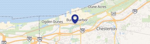
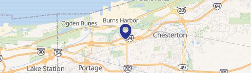
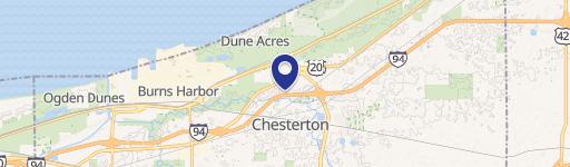
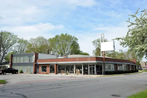
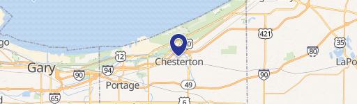
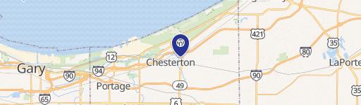
347 Us Hwy 20 Burns Harbor, IN 46304
Property profile & analytics
347 Us Hwy 20, Burns Harbor, IN 46304
- Warehouses
- 10,400 SF
- 2.27 lot acres
Property ID
US31-3445252
The Realmo ID is a unique identifier assigned to every property, incorporating country codes and precise geo-coordinates for 300x300-foot land blocks. It enables standardized data collection and seamless integration of disparate sources such as ownership, tax, title data and physical specifications. By aggregating current and historical records, the Realmo ID powers advanced analytics and delivers deep, verifiable insights for real estate professionals.
Location Intelligence
Current Use by Public Records
- Warehouses
Property Details for 347 Us Hwy 20
- Year built
- 1976
- Construction
- TYPE NOT SPECIFIED
- Lot size
- 2.27 lot acres
- Property type
- Warehouses
- APN
- 64-06-05-401-002.000-024
- APU
- 640605401002000024
Sales History
| Date | Price | Buyer | Seller | Deed Type | Mortgage |
|---|---|---|---|---|---|
| Apr 2, 2018 | — | 347 Melton LLC | — | Deed · related | $504k · First St Bk/porter |
| Feb 7, 2018 | — | 347 Melton LLC | — | Deed · related | $414k · Private Individual |
| Jun 30, 2008 | — | 347 West Melton Road LLC | Dean Ruth E Trust | Warranty Deed | $380k · First Source Bank |
| — | — | 347 Melton LLC | — | Deed Of Trust · related | $414k · Private Individual |
| — | — | 347 Melton LLC | — | Loan Modification · related | $504k · First St Bk/porter |
Value Estimations
based on Realmo’s proprietary methodology
-
AI approach
-
CAP approach
-
Comparable approach
-
Alternative Use
Get a detailed, property-specific estimation — fast and free
Location Insight
- Map
- Local Demand
- City
- Burns Harbor
- County
- Porter
- State
- Indiana
- Longitude
- -87.1337
- Latitude
- 41.6006
- CBSA code
- 16980
- CBSA name
- CHICAGO-NAPERVILLE-JOLIET, IL-IN-WI METROPOLITAN STATISTICAL AREA
Property Tax & Assessments
Tax date
Tax Amount
Assessed Land Value
Assessed Improvement Value
Total Assessed Value
Applied Tax Rate
Land Market Value
Improvement Market Value
Total Market Value
2023
$6,998
$152,500
$177,200
$329,700
-
$152,500
$177,200
$329,700