Back to Search
Property profile & analytics
OFF-MARKET
Estimated value
$5,500,000
Manufacturing properties
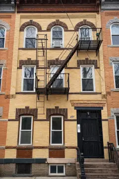
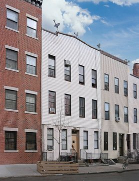
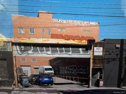
330 Melrose St Brooklyn, NY 11237-1937
Entity Owned
2-yr Hold
~
Est. High Equity
Property ID
US63-0804697
Property profile
Verified
Property type
Manufacturing properties
Use group
FACTORY (MANUFACTURING)
Year built
1931
Total area
13,500 SF
Lot
0.11 ac (5,000 SF)
Zoning code
R6
APN
03165-0017
UPID
US63-0804697
Cap rate & NOI
Priority signal for investors
Implied cap rate, NOI & suggested price
Cap rate vs submarket · NOI estimate · 3 price anchors
Implied cap rate, NOI & suggested price
Cap vs submarket · NOI estimate · 3 price anchors
Current use
Occupant on record · Public records
-
Dr. Eden M. Stetson, DDS Physician
-
Combustible Colors Marketing & Advertising (Bike/Boat/Book/etc) Store
-
Square Roots Urban Growers Food Processing Plant
Value estimations
Realmo proprietary · 4 methods
AI Approach
AI
$5.50M
CAP Approach
CAP
$3.70M
Comparable Approach
Comparable
by Request
Blend (final)
Blend
$5.50M
Owner & transaction history
Three Thirty M LLC · 2 yrs held
Three Thirty M LLC
since 2024
Last sale
$5.5M
7 recorded transactions
Zoning & alternative use
R6 · Brooklyn, NY
Permitted uses
Permitted uses
Allowed · conditional · prohibited
Cap rate
Implied · in-place · derived from last sale + estimated NOI
Implied Cap rate
#1
Implied · in-place · NOI ÷ last sale
In-place · derived from last sale + estimated NOI
Cap rate, NOI & submarket benchmark
Implied cap rate vs Brooklyn submarket · NOI estimate · Typical band, median & reading
Implied cap rate, NOI & submarket benchmark
Cap vs Brooklyn submarket · NOI estimate · typical band, median & reading
Refine your cap rate
8-question underwriting flow
1.
Property current status — Going-In vs Stabilized
2.
Price for denominator — asking / offer / market
3.
Leasing status & lease structure (NNN / Gross)
4.
Tenant risk profile & vacancy assumption
5.
Upload T12 / rent roll / OM (optional)
Refine in 60 seconds, get exact suggested price
T12 upload · Submarket benchmarks · Sensitivity grid
Suggested price · 3 cap rate anchors
Income approach @ 5% / 7% / 9% — aggressive / typical / conservative
Suggested price at 5% / 7% / 9% cap
Aggressive / typical / conservative · Implied $/SF per anchor · Sensitivity grid
Suggested price at 5% / 7% / 9% cap
Aggressive / typical / conservative · implied $/SF · sensitivity
Value
AI, CAP & Alternative Use estimations · Realmo proprietary blendValue Estimations
Based on Realmo’s proprietary methodology
AI Approach
Method
Estimation
Statistic approach
$5,500,000
ML approach
$5,500,000
CAP Approach
CAP Return
Estimation
6%
$4,005,000
6.5%
$3,695,000
7%
$3,430,000
Alternative Use
Use
Estimation
INDUSTRIAL (GENERAL)
$7,660,000
Current use
OFFICE BUILDING
$7,430,000
Change: -3% · Conversion: Difficult
WAREHOUSE, STORAGE
$6,765,000
Change: -12% · Conversion: Easy
Blend value · Realmo final
$5.50M
Range $4.95M – $6.05M · ±10% · vs last sale $5.50M (May 31 2024)
Last sale anchor
$5.50M
May 31 2024
Realmo estimate · informational only.
These numbers are calculated by our models from public records and may not reflect actual market value.
Not an appraisal.
Verify with a licensed appraiser before transacting. Realmo accepts no liability for divergence from real-world outcomes.
View the full estimation — every method, every assumption
Confidence drivers & risk notes · Custom comparable set · Free for first 3 / day
Full estimation methodology
Every method · every assumption · confidence drivers
Price per SF
Sale + rent benchmarks
Subject property
$407 / SF
Submarket sale & rent benchmarks
Median sale $/SF · Asking & closed rent · Submarket vacancy
Submarket sale & rent benchmarks
Median sale $/SF · asking & closed rent · submarket vacancy
Property tax & assessments
Tax year 2024Property tax & assessments
Tax year 2024
Tax billed
$80,312
Tax year 2024
Assessed value
$834,300
Assessed 2024
Previous assessed
$832,500
+0.2% YoY
Effective rate
9.63%
On assessed value
Assessed land
$135,000
Assessed improvement
$699,300
Land market value
$300,000
Improvement market value
$1,554,000
Total market value
$1,854,000
Applied tax rate
4.0000
Comparables
6 recent transactions · within 1.5 miComparable in this city
6 recent transactions
Comparable in this City


Similar Nearby for Sale


Similar Nearby for Lease


Recent comparable sales
Sale price & price/SF · Sale date & distance · Adjustments & confidence
Recent comparable sales
Sale price & $/SF · sale date & distance · adjustments
Property description
Physical attributes from public recordsBuilding & lot
Public records
Property type
Manufacturing properties
Use group
FACTORY (MANUFACTURING)
Status
Off-Market
Year built
1931
Heating
NONE
Buildings
1
Stories
3
Units
4
Total area
13,500 SF
Lot
0.11 ac (5,000 SF)
Zoning code
R6
APN
03165-0017
UPID
US63-0804697
Jurisdiction
KINGS(BROOKLYN)
Metro division
NEW YORK-WHITE PLAINS-WAYNE, NY-NJ METROPOLITAN DIVISION
Zoning & alternative use
R6 · Brooklyn, NY
Zoning R6 · permitted uses
R6 · Brooklyn, NY
Permitted & conditional uses
Allowed uses · Special-permit conditions · Prohibited uses
Permitted & conditional uses
Allowed · special-permit conditions · prohibited
Brooklyn. Always verify with local authorities before improvements.
Alternative use value scenarios
Repositioning upside vs current use
INDUSTRIAL (GENERAL) Current
Est. value
$7.7M
OFFICE BUILDING
Est. value
$7.4M
WAREHOUSE, STORAGE
Est. value
$6.8M
INDUSTRIAL (GENERAL) Current
OFFICE BUILDING
WAREHOUSE, STORAGE
Alternative use deep dive — conversion cost, permits, timeline
Conversion cost estimate · Permit path & risks · Stabilized NOI per option
Alternative use deep dive
Conversion cost · permit path · stabilized NOI per option
Building & site characteristics
From public records
Year built
1931
Heating
NONE
Stories
3
Buildings
1
Units
4
Lot
0.11 ac
Current owner
From public records · entity-resolved
Three Thirty M LLC
Entity
Mailing address
543 BEDFORD AVE, BROOKLYN, NY 11211-8511
Ownership since
2024
Owner contacts — direct phone, email, and related entities
Decision-maker phone · Verified email · Related entities & filings
Owner contacts
Email · phone · related entities
Sales History
11 recorded events · public records
Date
Price
Buyer
Seller
Deed Type
Mortgage
Aug 7, 2025
—
Three Thirty M LLC
—
Deed
related
$5,500,000 · Citi Real Estate Funding INC.
May 31, 2024
$5,500,000
Three Thirty M LLC
Melrose Deals, INC.
Deed
$3,030,000 · Bcc Funding II LLC
May 31, 2024
—
Three Thirty M LLC
—
Deed
related
$1,220,000 · Bcc Funding II LLC
Dec 6, 2019
—
Melrose Deals INC
—
Deed
related
$100,000 · Cross River Bank
Sep 28, 2018
—
Melrose Deals INC
—
Deed
related
$3,300,000 · Other Institutional Lenders
Apr 16, 2018
—
Melrose Deals INC
—
Deed
related
$2,600,000 · Tbg Funding LLC
—
—
Melrose Deals INC
—
Loan Modification
related
$100,000 · Cross River Bk
—
—
Melrose Deals INC
—
Deed Of Trust
related
$166,153 · % The Battery Group LLC
—
—
Melrose Deals INC
—
Loan Modification
related
$3,300,000 · Other Institutional Lenders
—
—
Sharf Machinery LLC
—
Deed Of Trust
related
$1,000,000 · Galster Funding LLC
—
—
Melrose Deals INC
—
Deed Of Trust
related
$325,974 · Dime Savings Bank Williamsburg
Coming soon
Costs & Benchmarks
Operating expenses, capex projections, utility benchmarks, and submarket comparables — all in one view.
Coming soon
Risks
Flood, climate, environmental, title, and tenant-concentration risk — surfaced with mitigations and source citations.
Try Rey
Ask anything about this address in plain English.
“Is 15.6% cap rate sustainable?” · “Best tenant mix for BU1?” · “What’s the redev upside?”
You own 330 Melrose St?
List it free. Reach 20,000 daily buyers.
We’ve already pulled the facts. Confirm photos + price and you’re live in 2 minutes.
List this address →
Full reports are paid
Unlock the full Property Analytics report
Start free for 7 days — no card required. Full owner contacts, all 4 valuations with methodology, refine flow, comparable adjustments, foot-traffic deep dive, export to PDF / CSV.


