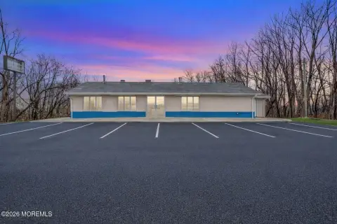
320 State Route 33 Manalapan, NJ 07726
Property profile & analytics
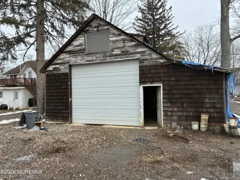
320 State Route 33, Manalapan, NJ 07726
- Grocery and convenience stores
- 1,360 SF
- 1.54 lot acres

Property ID
US59-1266545
The Realmo ID is a unique identifier assigned to every property, incorporating country codes and precise geo-coordinates for 300x300-foot land blocks. It enables standardized data collection and seamless integration of disparate sources such as ownership, tax, title data and physical specifications. By aggregating current and historical records, the Realmo ID powers advanced analytics and delivers deep, verifiable insights for real estate professionals.
Location Intelligence
Current Use by Public Records
- Grocery and convenience stores
Property Details for 320 State Route 33
- Year built
- 1950
- Lot size
- 1.54 lot acres
- Property type
- Grocery and convenience stores
- APN
- 28 07232-0000-00002- 05
- APU
- 280723200000000205
Sales History
| Date | Price | Buyer | Seller | Deed Type | Mortgage |
|---|---|---|---|---|---|
| Sep 19, 2024 | $950,000 | Rebel Realty Group INC | Rehab Restty Croup INC | Correction Deed · related | $760k · M & T Bank |
| Aug 11, 2015 | $215,000 | Rehab Realty Group INC | 320 Cmf LLC | Grant Deed | — |
| Jun 12, 1995 | $225,000 | Constance Martucci | Dancin Lady Country INC | Grant Deed | $210k |
Value Estimations
based on Realmo’s proprietary methodology
-
AI approach
-
CAP approach
-
Comparable approach
-
Alternative Use
Get a detailed, property-specific estimation — fast and free
Location Insight
- Map
- Local Demand
- City
- Manalapan
- County
- Monmouth
- State
- New Jersey
- Longitude
- -74.372
- Latitude
- 40.2551
- CBSA code
- 35620
- CBSA name
- NEW YORK-NORTHERN NEW JERSEY-LONG ISLAND, NY-NJ-PA METROPOLITAN STATISTICAL AREA
Property Tax & Assessments
Tax date
Tax Amount
Assessed Land Value
Assessed Improvement Value
Total Assessed Value
Applied Tax Rate
Land Market Value
Improvement Market Value
Total Market Value
2023
$5,825
$110,400
$240,300
$350,700
-
$110,400
$240,300
$350,700